Stats
Distance: 6 miles
Elevation gain: 3400' (cumulative)
Class (difficulty): 2
Time: 4.5 hours
Report:
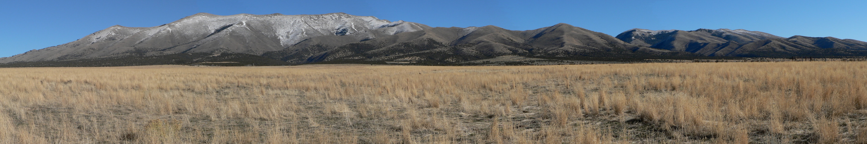
I've had my eye on the Black Pine mountain range for quite sometime. That is the range that is so visible on the west side of I-86 as you near the Utah border while driving down I-84. I'd always envisioned visiting this range during April or May since it appeared the range was fairly barren and would likely be free of snow before the higher mountains in central Idaho. Later I decided I might be able to do it during winter. Two years ago, on the day after Thanksgiving, I got all geared up to climb in the range, but a huge storm would not relent and I ended up climbing a more accessible peak closer to Twin Falls. This year, I saw the weather would be perfect for an attempt, so I planned it again for the day after Thanksgiving again. While the weather forecast was perfect, I was worried about it being cold and if I would be able to drive up the canyon to the 6,000' location where I wanted to make the approach from. The nearest snotel (across the valley near Pomerell Ski Area) checked in with nearly 2 feet of snow. I knew the Black Pine range would have less snow because it lies in the rain shadow of the Albion range, but how much less? So off to bed I went, worried about snow covered roads, a trudge through deep powder, and the BSU - Nevada football game the day after the hike.
My wife woke me up at 4am. She was doing the Black Friday shopping thing and I needed up early to be back in time to visit with family that evening. So out the door I headed. I had decided I would try for a western approach, driving south of Malta and going up Sixmile canyon to the end of the road. As I drove, I realized I never figured out how to get to Malta, hadn't brought Tom's book (as I would find out later, Tom didn't have directions for Sixmile Canyon anyway), nor did I bring my atlas. My dad had commented the night before that Malta had its own exit on the Freeway, so I stuck by that knowledge and kept heading down I-84. After the junction with I-86, I started worrying. But shortly after, the exit appeared and I was on my way.
After reaching Malta, I could see the Black Pine range siloutted against the brighter sky behind it. I didn't know how far south of Malta to go, but faintly remembered estimating it at 13 miles near a abandoned town named Bridge. Sure enough, at 13 miles there appeared a small town and a turnoff for Sixmile canyon. I remembered the canyon was a straightshot east of Bridge, so I drove up the road expecting to follow it without detours until it passed Sixmile reservoir and entered a tree-lined canyon. However, about 1 mile from the base of the mountains, I reached a junction. The options were straight, which I thought was the right answer, but a sign pointed south for Sixmile and Kelsaw canyons. So south I headed. After driving at least 20 minutes on a bad road and knowing I had gone way too far, I finally reached Kelsaw Canyon. The sun was starting to come up, so I headed back thinking to myself I couldn't have hiked in the dark anyway, so letting it get light was a good thing. Making it back to the junction, I thought I would go straight east on the road again. This led to a private residence and gated roads. I studied the topo and noticed that Eightmile Canyon to the north had a side road that headed to 6500'. So I headed to find that road. After 15 minutes of searching, all I could find were ATV trails and locked gates. Back to the junction I went. Desperate and about to give up, I told myself I had one more shot and would turn east on the next road south of the junction. Exactly .75 miles south of the junction, I saw a road heading east. I had seen it before, but it seemed less-traveled than what I was expecting, and was gated. I opened the gate and headed up the road. Within minutes I realized it was the right road, as it quickly turned toward the canyon, became well-traveled, and passed a "National Forest" sign.
I drove past Sixmile Reservoir and even Sixmile Springs before the road steepened, narrowed, and became snow-bound. The combination of the three told me it was time to park. From my parking spot I could see the route all the way to the crest of the range. It looked like only a few sections would have snow, and even those sections would have only a few inches. So up the canyon I headed. After hiking about a mile on an ATV road in the canyon, I finally got to a location where I decided to leave the canyon and head up the open slopes toward Black Pine Peak.
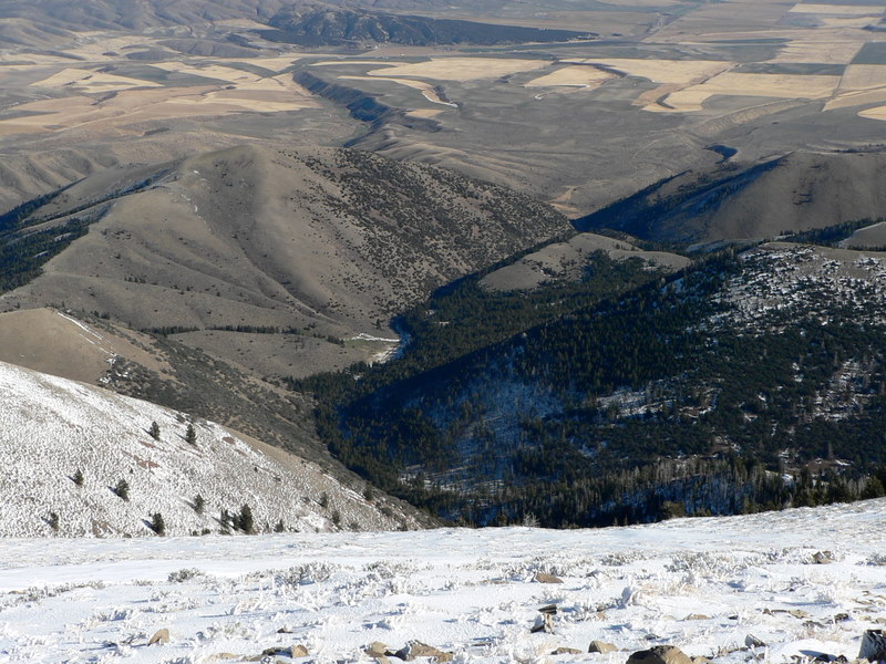
The slopes were steep, but the brush wasn't thick enough to be a hassle, nor was the snow deep enough to slow me down. I made it to about 7800' before taking my first break. The views of the Cache Peak in the Albion Range were spectacular from here. I could see the ridge before me all the way to the crest and there were no obstacles. The day was becoming warm, with bright blue skies, excellent visibility, and little wind. I continued on my way.
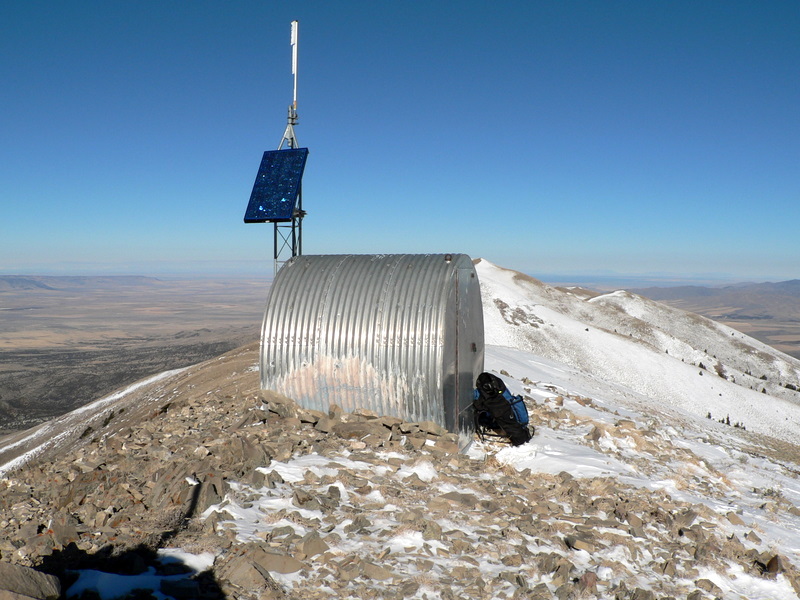
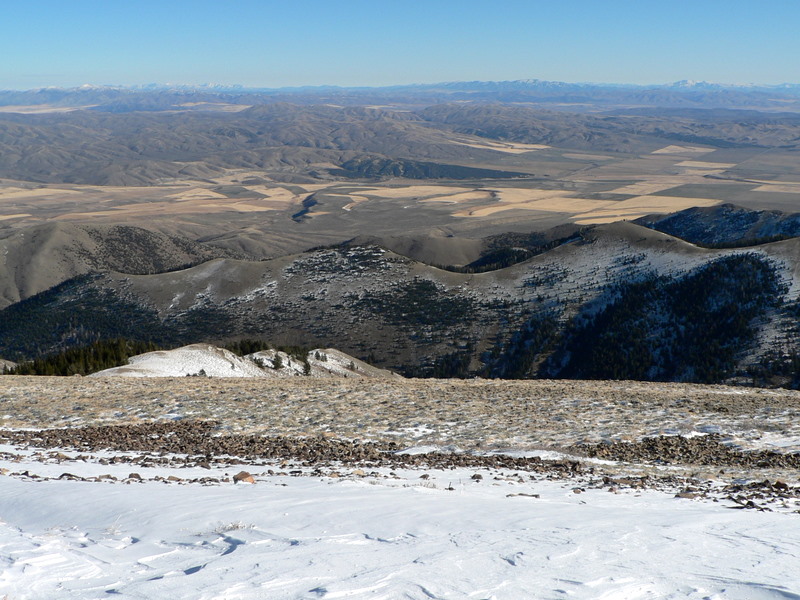
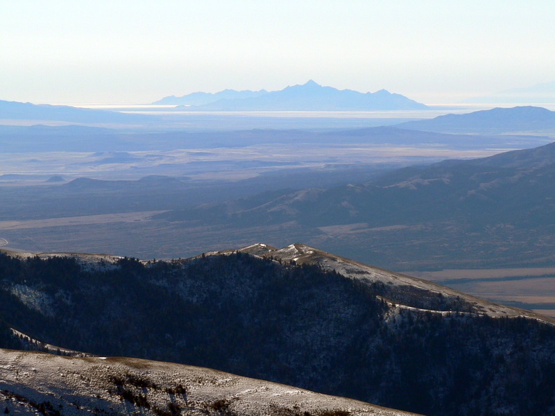
About 300 or 400 feet from the top of the ridge, I could finally see a small structure on top of a peak to my south. I had seen photos of Black Pine Peak, so I knew I was right on track and started angling southeast toward the peak. The wind started picking up here and I quickly layered up. Once on the ridge, I decided it was face mask and goggle time. Soon I was standing on top of the peak, checking out views in all directions, including the Great Salt Lake to the south. It was so clear I could even see the snow capped peaks of Idaho's central mountains approximately 150 miles north of me!
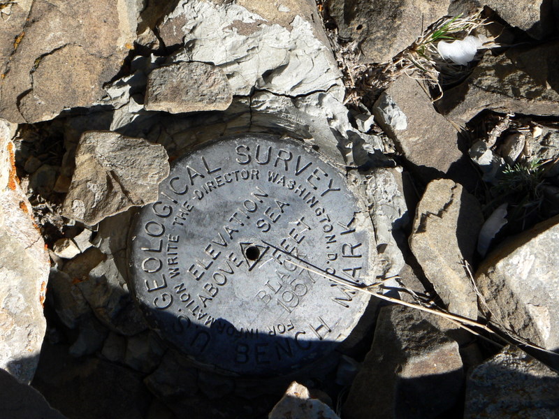
After some photos and time getting warm hiding behind the structure on the summit, I decided to head toward the higher Black Peak, located about 1.25 north of me. The ridge was gorgeous, with valleys that drop quickly below it on its western and eastern sides. The ridge walk was fun, but I didn't bring my hefty fleece pants to keep my legs as warm as I would have liked and I was too lazy to add my shell pants. The traverse took little time and I was soon facing a final 200' gain. That gain went easier than expected and in no time I was on top of my second peak on this November day. The views were still phenomonal. I found a cairn, benchmark, the remnants of a triangulation station, and was in awe of the views. The day was so clear, that I couldn't get myself to leave. I just walked around, taking photos and taking in views from every direction. Soon the cold and a call from my wife got me heading back down.
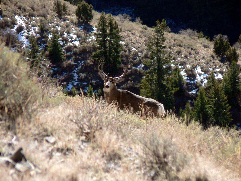
On the way down, I spotted a large buck about 30 feet below me. I couldn't believe it, but he hadn't seen me. I ducked and grabbed the camera. When I finally had the camera ready and stood back up, he turned his head and posed for my pictures for several seconds. Despite hunting season only recently ending, he didn't seem to care I was there and never did run or even walk away quickly. The rest of the hike down was uneventful and soon I was heading back to Twin Falls, where it would be time to wait for my next big event... the BSU - Nevada football game and the millions of dollars, BCS-bowl game, and winter vacation to the Fiesta Bowl riding on it. (Of course, BSU won in convincing fashion and a future trip report will surely contain pictures of football and trip reports for a warm, Arizona peak... stay tuned.)
Getting there:
Drive approximately 13 miles south of Malta on Highway 81. Turn east onto the signed Sixmile Canyon Road. Follow the road due east for approximately 5.4 miles to a junction. You will see a sign with arrows pointing south to Sixmile Canyon, Kelsaw Canyon, and Strevell. Drive .75 miles south and turn east onto a road located just before a corral. Follow this road east toward the mountains. The road takes a left turn at 1 mile, and then passes 2 old cabins and turns right at 1.25 miles. At 1.7 miles, you merge with a road coming in from the northwest and enter the canyon. At 2.7 miles, you pass Sixmile Reservoir (which can be seen from the road). At 3.3 miles, keep left at a junction. I had to stop at around 3.9 miles in.
Hiking instructions:
I continued up Sixmile Canyon on a ATV trail until I could access the west slopes leading to 9200' hump located just north of Black Pine Peak. I then turned south and ascended Black Pine Peak. From Black Pine Peak, I followed the ridge north toward Black BM. The 2 bumps on the ridge south of Black BM can be skirted on their west sides (though the second one is so minor, climbing it probably only adds 50 feet to the elevation gain on the day).
|
|
Photos
|
|
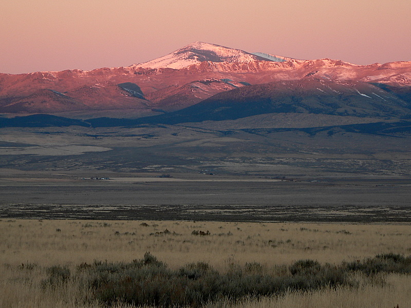
| Cache Peak early in the morning from the approach road. |
Cache Peak from higher up on the climb. |
| |
|
|
|
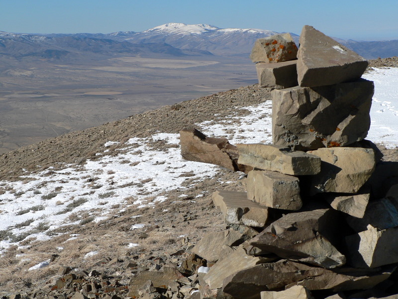
| The summit building on Black Pine Peak. |
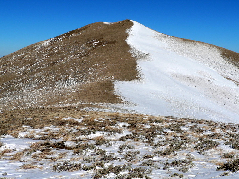
The view of the ridge north from Black Pine Peak. |
| |
|
|
|
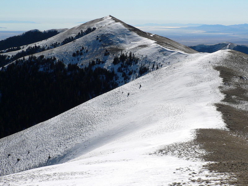
| Looking back at Black Pine Peak. |
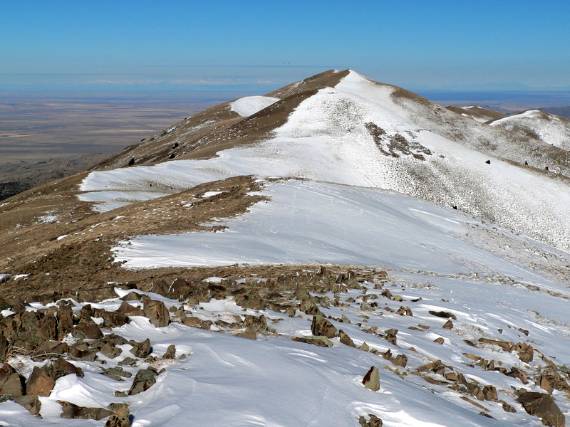
Looking north to Black Peak. |
| |
|
|
|
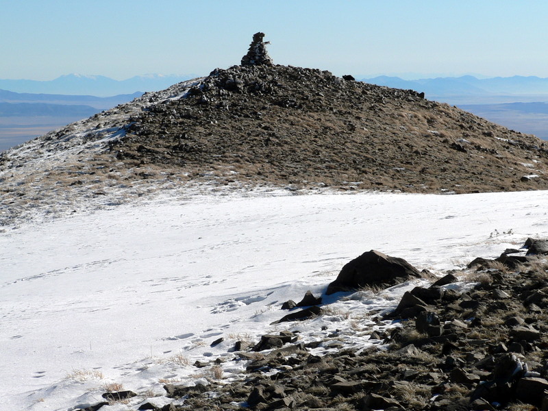
| The cairn atop Black Peak. |
Black BM. |
| |
|
|
|
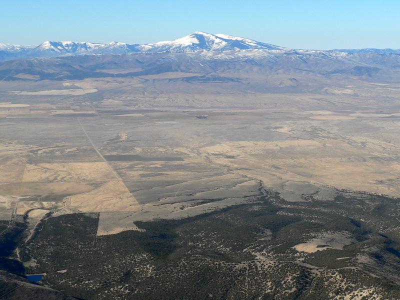
| Looking down at the eastern approach via Pole Canyon. |
Looking east. |
| |
|
|
|
| Looking south at the Salt Lake. |
Cache Peak from Black Peak. |
| |
|
|
|
| Mount Harrison from Black Peak. |
A buck deer I ran into on the way down. |
| |
|
|
|
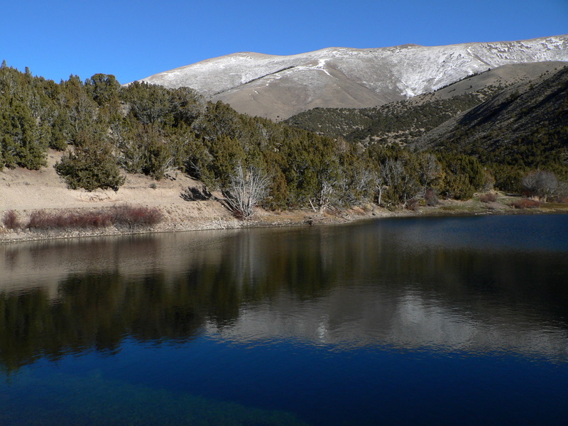
| Sixmile Reservoir with Black Pine Peak behind. |
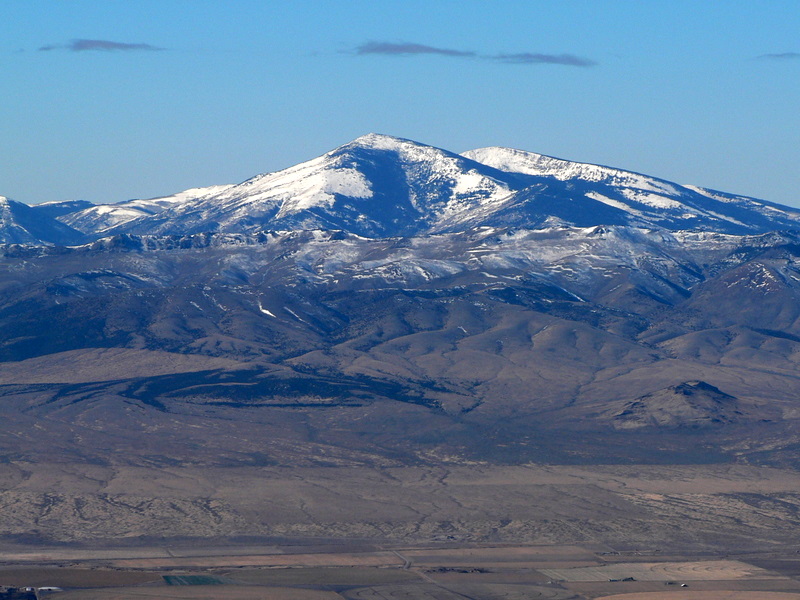
The Black Pine Mountains from Malta. |
|