RockyMountainSummits.com Home  |  My Peak List  |  Message Board  |  Contact Me  |  View the Guestbook  |  Sign the Guestbook


Mount Breitenbach - 12,140 Feet


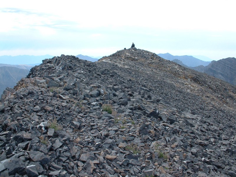
The summit of Mount Breitenbach... the infamous "Summit Dawg" takes in the view.

Trip Report (8/16/2003):
I thought I was in trouble with back-to-back Lost River climbs planned (Breitenbach, then Idaho). However, I was pleasantly surprised that Breitenbach was not that bad. The route up Pete Creek (pronounced "crick" by North Dakotans) was very pleasant on solid rock and a moderate pitch. I teamed up with Richard Wallace for this hike, and we basically followed the Pete Creek canyon east to the 11,400 foot saddle on the Lost River crest, before turning north and climbing a steep 600 feet to the southern reaches of the Breitenbach summit ridge. From there, the route followed the up and down and sometimes knife-edged ridge to the summit of Breitenbach. Here we peered down at the famous north face and assigned names to all of the peaks we could see on the ridge heading north from us (you can pretty much see everything as far north as Borah Peak). We then headed down. While not as fast as going down other Lost River peaks, you can still get a few scree slides in on Breitenbach.

Like I mentioned before, most of this hike is on stable rock... a rarity for the Lost River range!

Trip stats:
Time: 7 hours
Length: 8 miles
Elevation Gain: 4600 feet
Class (difficulty): 2

Directions:
Turn east on Upper Cedar Creek road off of Highway 93 exactly at milepost 115. This road is well marked with a sign. Drive three miles east and right after crossing a canal head northwest next to the canal. There was about a foot of water in the canal, so although a passenger car might make it, I would recommend a high clearance vehicle. In addition, the going from here remained rough. After crossing the canal, reset your odometer to zero. As you go along the canal, take the first right which is in less than a quarter mile away. You should be going east northeast, and then you will want to take the next left at a four way intersection. This turn also comes up on you quickly. Follow this "road" north and when your odometer hits 1 mile, there will be a very vague fork, go right on what appeared to be the less traveled road. You should still be going north and then you will cross two larger ditches. After crossing the second ditch, make a hard right even though there doesn't appear to be a road. Follow this east and when you hit heavier sage brush, you will pick up the road again which winds its way to the mouth of the Pete Creek Canyon. All of these jeep trails are primitive and be prepared to possibly scratch your vehicle up a bit from the overgrown sage brush along the side of the road. You will need high clearance and possibly a 4 x 4 to access this trailhead.

Route:
Follow Pete Creek canyon east to the 11,400 foot saddle on the Lost River crest, before turning north and climbing a steep 600 feet to the southern reaches of the Breitenbach summit ridge. From there, the route followed the up and down and sometimes knife-edged ridge to the summit of Breitenbach.

Pictures: Click on the pictures below to see the full-size version.
The Lost Rivers rising to the north.
The narrow summit ridge from the top of Breitenbach.
The route up Pete Creek.
 
Looking up the route, about half way to the saddle from the head of Pete Creek.
Towers that surround the route up the canyon.


Please send comments, suggestions, and questions to dan@idahosummits.com.
© 2001 All Rights Reserved RockyMountainSummits.com