Mount Hood from the town of Mount Hood. We climbed from the opposite side of the mountain.
Trip Report (6/15/2003):
This winter I decided that I would like to climb Mount
Hood, the state highpoint in Oregon.
Plans came and went until about a month ago, when Jim Just and I made a plan to
summit Lost River Peak in Idaho using crampons and ice axes (as training), then
climb Hood two weeks later. This would be Jim and my first climbs on steep
snow. We did fine on LostRiverPeak, but decided we would take a
snow climbing course while at Mount Hood. Mount Hood is not a wildly dangerous mountain,
but last year's accident where 3 people perished acts as a reminder that it is still somewhat dangerous. We figured
the snow class would put us at the skill level we wanted to be at for the climb.
On Friday, I picked Jim up at his house in Meridian
and we were off to Oregon. It was
80 degrees or so when we departed. Most of the way, the temperature was 85
degrees or so. Just outside of Hood River, Oregon
we got our first view of Hood. It was looking giant,
but we could not see the top, as it was shrouded in clouds. About an hour and a
half later, we arrived at the Timberline lodge, where the south-side route up
the peak starts. It was foggy, misting, and 37 degrees. We were in shorts and
sandals. What a change in 6 hours of driving time!
After poking around the vintage lodge, we headed down to
Government Camp (6 miles away) and found a campground. It was in a deep forest
and the temp was very cool that first night. While on a bathroom break, I
discovered deep snow under a fallen tree. Did I mention the campground’s
elevation was 3,000 feet and it was mid-June?
The next morning, we were back at the lodge for our snow
school at 9 AM. One instructor was an
Irishman named Joe. He was very experienced and quite funny. The other’s name
was Nick. Nick was younger and basically training to become a guide, but still
had an impressive resume. We had 4 classmates… a husband and wife, and 2 women
by themselves. The couple had been on Rainier and
several other peaks. The other women had never done anything like Hood. We
spent the day learning how to walk on snow, use an ice axe, arrest our falls,
etc… Throughout the day, the summit was in and out of cloud, with overcast skies elsewhere. The instructors
told us that conditions that night would be perfect (clear and cold).
After the class was over, Jim and I thoroughly debated when to start the next day and
whether or not to camp higher on the mountain or just drive up from our
campground in Government Camp. We dined at a restaurant, where we decided we
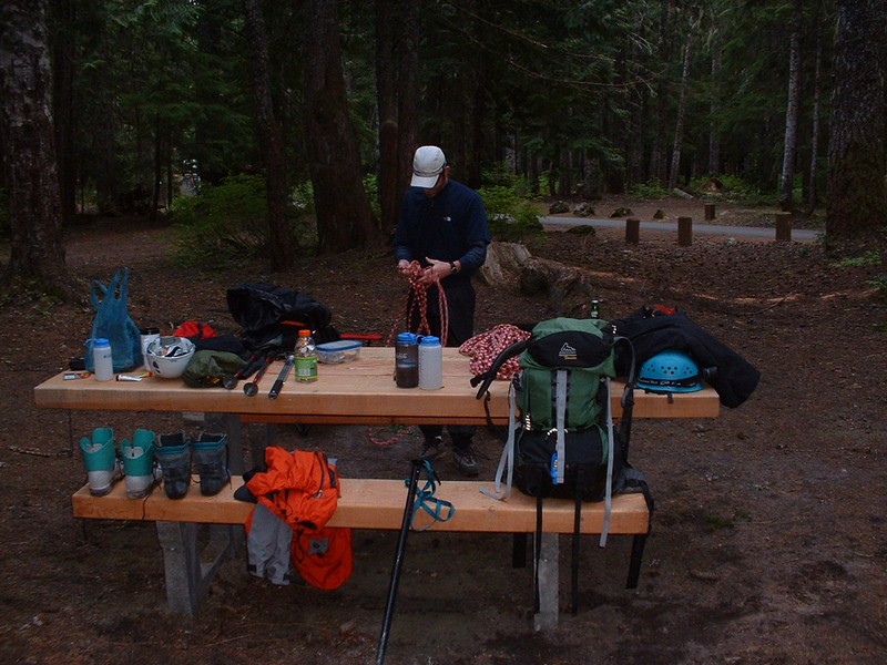
would just climb the entire mountain in one swoop and start at midnight. So off to our campground we went. We got
our gear loaded in our packs and were ready for a sleep at 7:30 PM, with the
alarm set for 11:30 PM. Sleep came easy for me at first, but after about an
hour, I was awoken by loud music nearby. Jim could not sleep, and eventually
got up to have a soda and speak with his wife on the phone. Once I awoke, it
was 2 hours of lying there, before dosing off for 30 minutes before the alarm
went off. Jim was not woken by the alarm, so I let him sleep about 5 minutes
before wrecking his peace and tranquility.
The weather was now beautiful. The full moon was out, as
were countless stars. With everything ready, we just threw on a few clothes and
our plastic boots and were off to the lodge. We arrived just after midnight. We signed in at the climber’s registry
and used the bathroom to fill water bottles.
We hit the trail and could notice a few dark silhouettes
against the white, moonlit terrain. The mountain was bright and we never used
the headlamps while climbing. The mountain had a lenticular cloud formed around
the top, but that would later relent to clear conditions. We got into a pretty
good rhythm and quickly passed a couple of hikers. The wind was blowing hard
and the snow was solid as a rock as we made our way on the eastern boundary of
the Mount Hood ski area. I was burning up for the first
hour, but the wind was blowing hard enough to prevent too much stripping down.
Just as we stopped for our first break at 1 ˝ hours and 1,500 feet of gain, I
started chilling a bit. Here we ate some snacks and drank water. I threw on a
down coat, which remained on until after the summit and totally miffed Jim (how
could I go from hot to wearing that thing).
Just after the break we got passed by a solo climber that
said his girlfriend had quit after 400 feet because she was feeling sick. He
almost seemed happy about that, as it relieved him of the burden of carrying
the rope! We continued up towards the top of the ski area at 8,700 feet, where
we took our second break and put on our crampons. The terrain was a bit
steeper, but I was really starting to feel good at this point. We just worked
our way straight up a feature-less snow slope. After about 1,000 feet more
elevation gain, we stopped for quick break behind some rocks. At this time we
could see some light on the far eastern horizon.
The next phase of the climb was up through some rocks to a
steep ridge where the Steel Cliffs were visible. Noticeable now was a pungent
smell of sulfur from the Devil’s Kitchen, which was an excellent reminder that
we were climbing a volcano. During the next 1,000 feet, I felt fine physically,
but the sulfur smell was making me nauseous. It became light during this
section as well. With the exception of one medium-length break, we moved
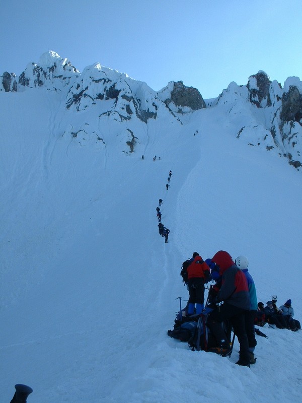
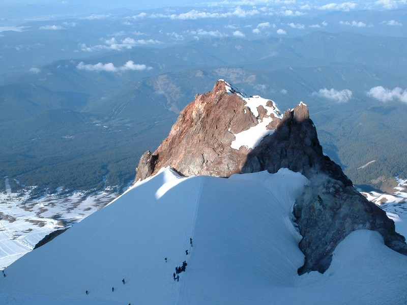
quickly towards Crater Rock and the Hogsback. The Hogsback is essentially a narrow
ridge that runs from Crater Rock up to the Pearly Gates (rocks on both sides of
a chute that leads to the summit). We rested with 10 or so other climbers on a
saddle, before mustering up the nad to tackle the crux of the climb, which is
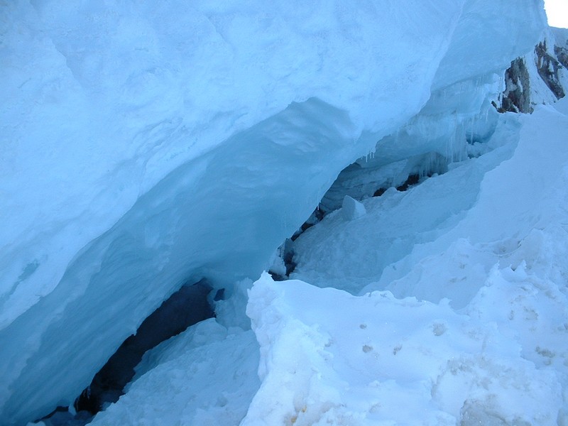
the section from the bergschrund (a giant crack in the snow) to the upper
portion of the Pearly Gates. We decided to fall in behind a knowledgeable
looking team of 4. We also decided NOT to rope up, as we figured the rope would
give us a false sense of security given our limited knowledge of how to use it
and our ability to arrest someone other than our self. This section was much
tamer than I expected and I really wanted to pass the rope team, but patiently
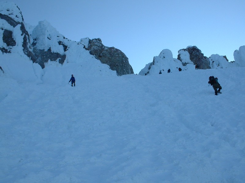
remained behind them. We finally pushed through the Pearly Gates and in 5
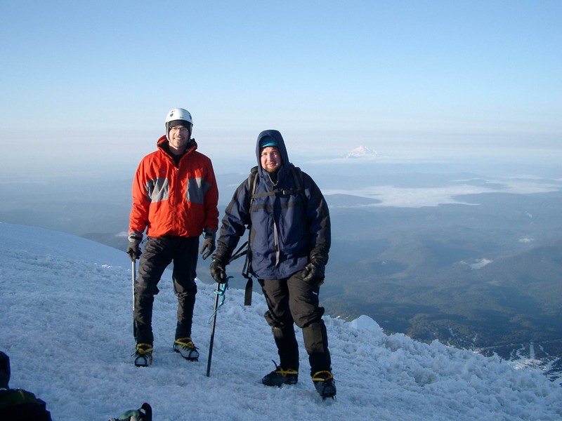
minutes were enjoying sunshine on the top of Oregon.
What a site! It had taken us just under 6 hours.
The way down was a bit nerving through the Pearly Gates, as
the terrain just didn’t feel quite right. So I just took my time and made my
own steps where needed. Jim was a bit skeptical, so I took the lead. Soon we
realized it was much easier than we thought and we motored back down to the bergschrund.
While taking pictures of the bergschrund, we heard a shout from our instructor’s
from the day before who congratulated us for our successful summit. They were
taking our classmates up a route known as the crater variation. Once back at
the saddle, we phoned our fathers to wish them a happy father’s day and did a
little celebrating. Other than ripping off a few glissades (sitting on your
butt and sliding down the slope), the down climb was pretty mundane. Mundane or
not, the accomplishment, views, and cobalt blue skies made every minute of it seem
heavenly.
Big thanks go out to Jim, who acted as my sherpa. Jim carried the
5 lb. rope, and helped with with my water and camera on several occasions. Beyond that,
he was an excellent climbing partner.
Trip stats:
Time: 9.5 hours (6 up, 3.5 down)
Length: 8 miles
Elevation Gain: 5300 feet
Class (difficulty): 4
Route:
We climbed Hood from the south side of the mountain, starting at Timberline Lodge.
Pictures: Click on the pictures below to see the full-size version.
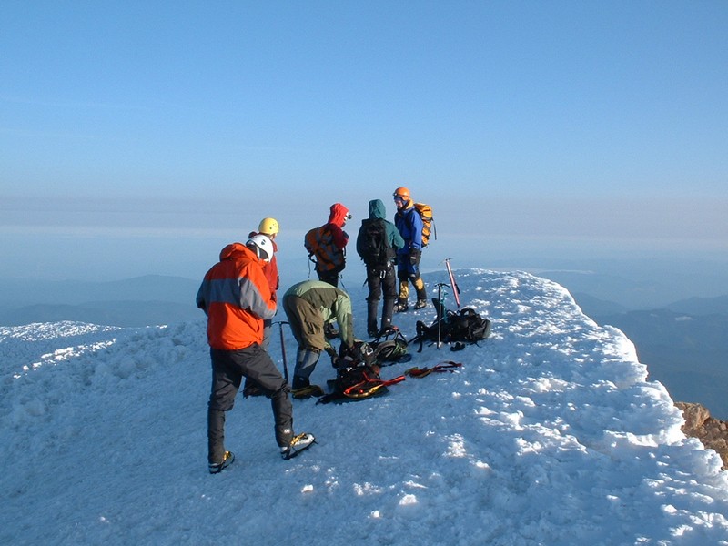
Getting ready at camp a few hours before starting the climb.
The Hogsback, the crux of the climb.
The bergschrund on the Hogsback.
The Pearly Gates, which signal the summit is near.
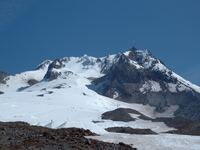
Crater Rock from above.
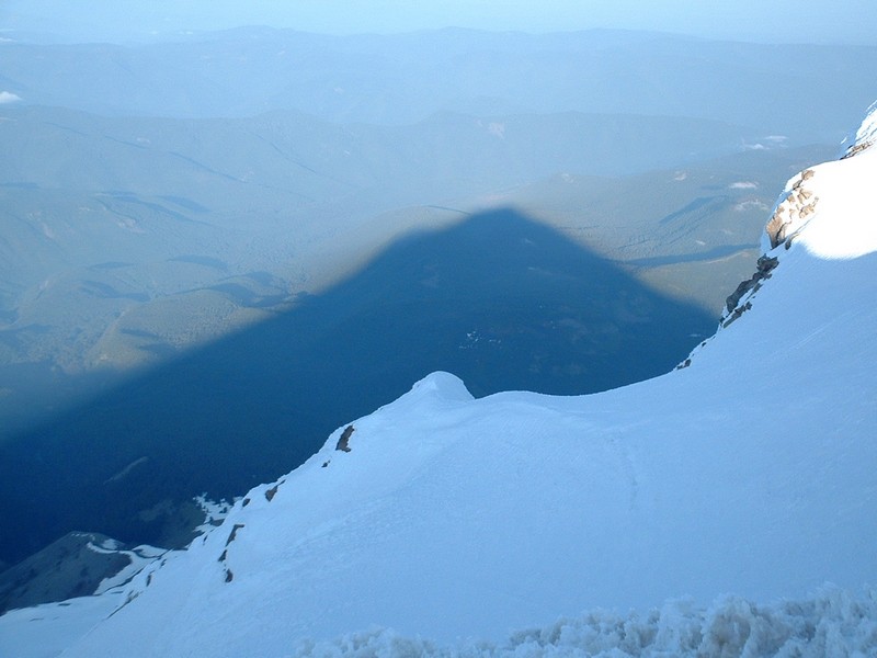
The southside of Mount Hood from about 7,500 feet.
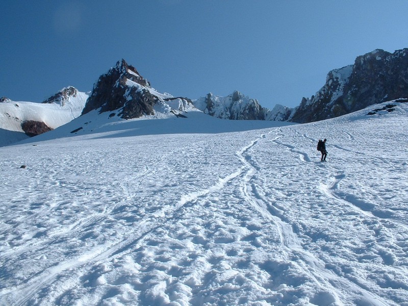
Glissade Paths at around 9,500 feet.
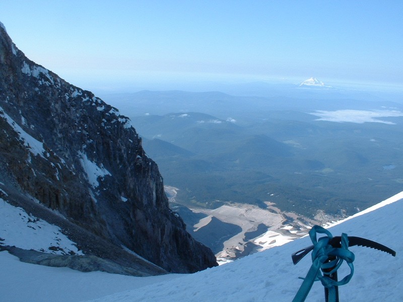
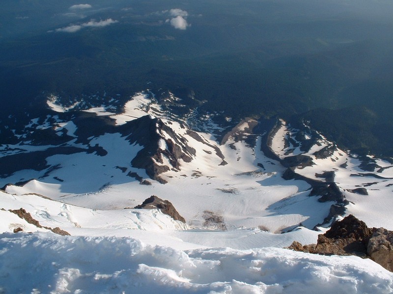
Steel cliffs, moraine fields, and Mount Jefferson.