Boone Peak (7004') and Quicksilver Mountain (8,082')
Also see my winter ascent trip report of Quicksilver here.
Location: 42.94778°N, 116.63222°W
Date: 4/29/2007
Distance: 18 miles
Elevation gain: 3800'
Class (difficulty): 3
Time: 9 hours
Report:
A couple of years ago in mid-November I climbed Quicksilver Mountain on a foggy and very windy day. Since visibility was near nil on that trip and I wasn't 100% sure I had summited because of the fog and limited ability to read my GPS (the GPS was covered in rime and hard to read because my hands would freeze trying to change screens), I've always wanted to come back and try the peak in better conditions. Not only did I have my own doubts, but someone told me there was a large cairn on the top of Quicksilver that would have been obvious.
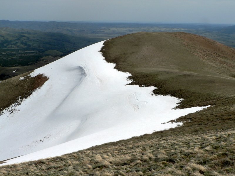
One cool feature of Quicksilver Mountain is a large drift on the northeast side of the mountain that runs about a mile just below the 3 main points that make up the summit ridge. This drift is so large it is easily viewable from Boise. In fact, last year it was still very large and visible from town in late July... not sure how long it stuck around. Seeing this drift from town also added to my interest in re-visiting the peak.
So on a warm, spring morning Zach and I headed down to the Owyhees. We contemplated a snow climb from the east side of the peak, up and over the big drift. We wasted about an hour searching for a way to the base of the peak from that side, but the roads were not in great shape.
Instead, we decided to head up to Toy Pass and come in from that way. In addition to Quicksilver, we decided to add an ascent of Boone Peak to the trip. The area on the south side of these peaks has a lot of private property. Not only is it signed and fenced off, but it is actively patrolled. I will not get into our route specifics because I don't want some landowner claiming we were on private property on the approach, but the ascents of the peaks themselves was on public land. Do some research before you go to make sure you avoid the private land.
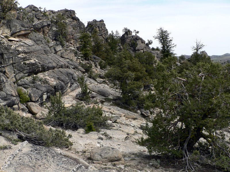
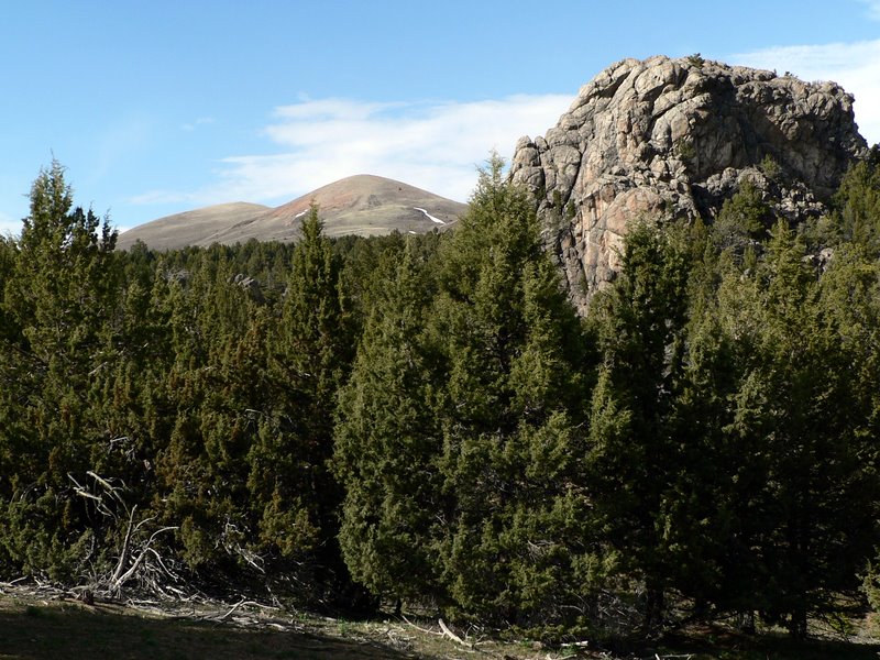
Since Zach is on this new kick of climbing the distant, not-so-tall peak first to better motivate us to climb both peaks we set out for. So we headed for Boone Peak first (even though Quicksilver was right there). We kept thinking Boone Peak might be lame, but when we finally spotted it, we realized it was pointy and surrounded by neat terrain of juniper trees and granite outcrops.
The granite outcrops really added to the challenge, as we weaved in, around, and over them. It was definately class 3 on several moves and took a lot of route finding to maneuver. Just below the summit, the granite outcroppings were gone and we faced a steep scramble up the final 100 feet on a talus slope.
The summit view from the top of Boone Peak was spectacular... we really lucked out by climbing this no-name peak. Boone sits by itself, off the main crest, and has 360° views. Especially impressive are the views to the south and west of the expansive Owyhee highlands and prominent South Mountain.
We were already a bit beat up on top of Boone, so we knew not to waste much time on Boone. Off we headed for Quicksilver.
We crossed the saddle between Boone and Quicksilver and headed up Quicksilver on a jeep trail. At a flat spot just east of Quicksilver, we left the road and made our way up the open slopes to the round and large summit area. The wind was roaring again... not nearly as bad as last time, but hard enough to make it difficult to catch your breath.
Very near the summit, was a mining dig... very similar to the dig I described to Zach that I remember seeing on my previous ascent of the mountain. That kind of made me sure I had really summitted the peak on my previous visit. And for what it's worth, no cairn was present on the summit.
The views from the top were not tremendous because of smoke from prescribed burns in the Boise National Forest, but Quicksilver stands tall above the Snake River Plain below, making for a dramatic plunge to the north and east from its summit. After taking in the views, checking out the hardness of the snow on the eastside of the peak, and climbing to the top of the southern summit we made the long descent to finish up the day.
Getting there:
From Boise make your way to Oreana via Idaho 78. From Oreana follow Bachman Grade Road to Toy Pass.
Hiking instructions:
See the report above...
|
|
Photos
|
|
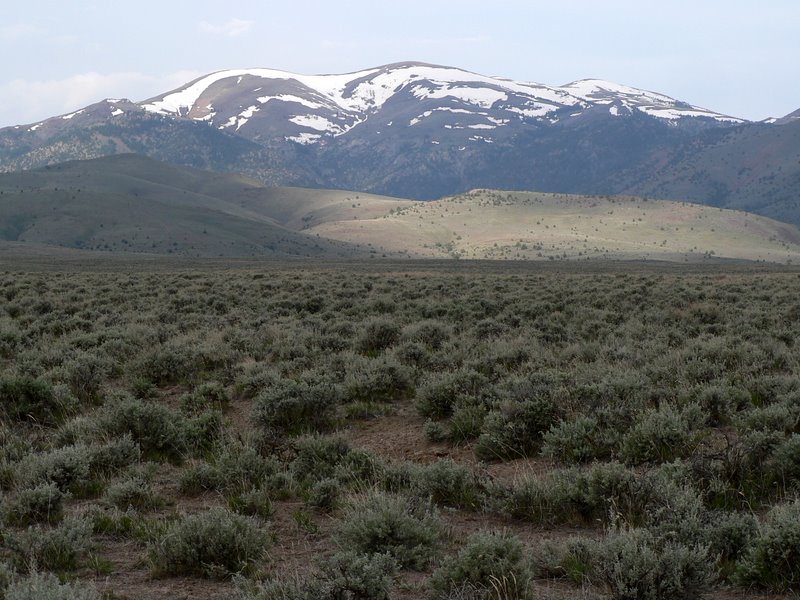
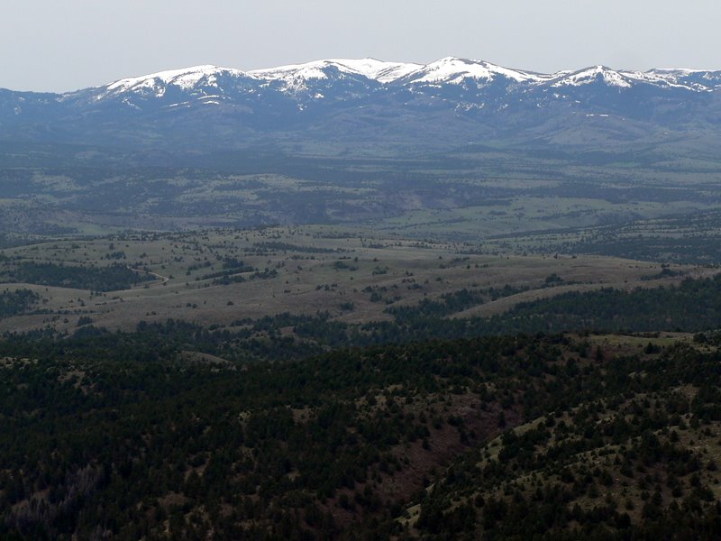
| Quicksilver from the valley floor. |
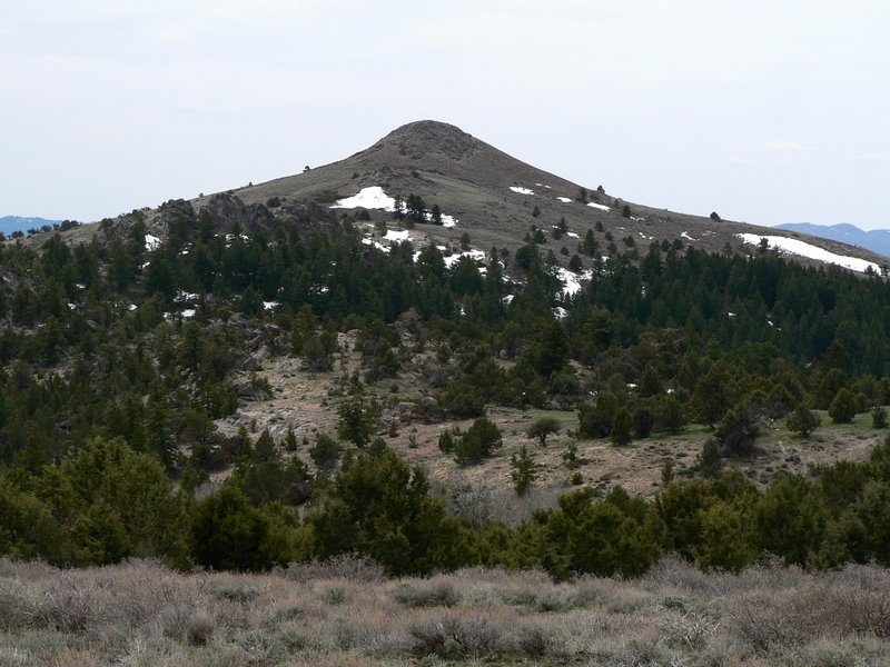
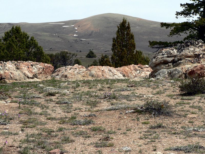
Boone Peak from the east. |
| |
|
|
|
| Rock towers near Boone Peak. |
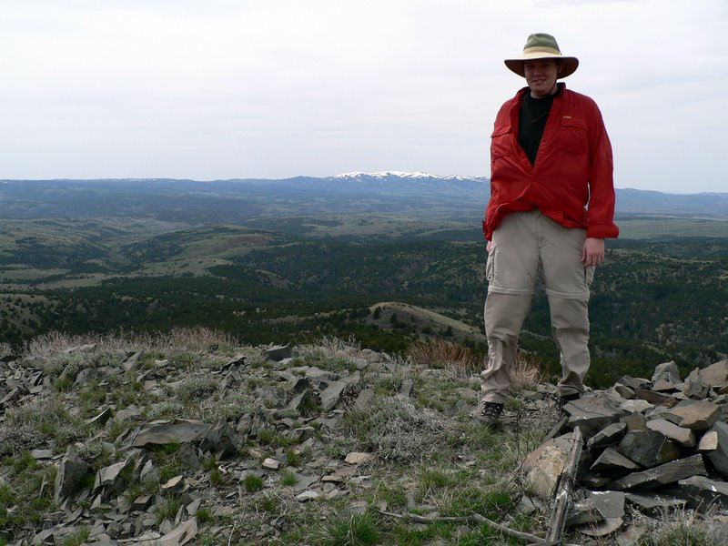
Zach on Boone Peak. |
| |
|
|
|
| South Mountain from Boone Peak. |
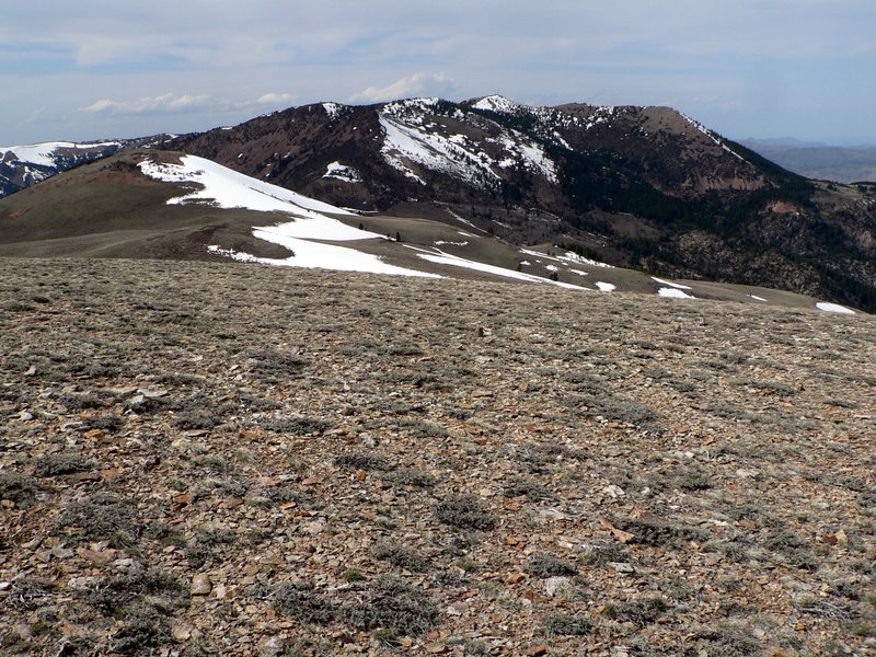
Quicksilver from the base of Boone Peak. |
| |
|
|
|
| Hayden from the top of Quicksilver. |
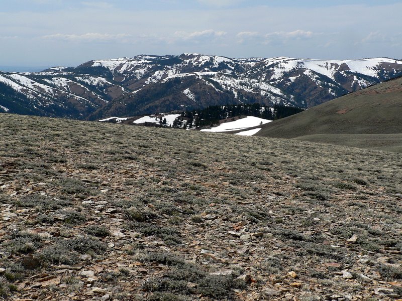
More Silver City Range peaks. |
| |
|
|
|
| Quicksilver's southern point. The drift in the photo is one of the largest in Idaho. |
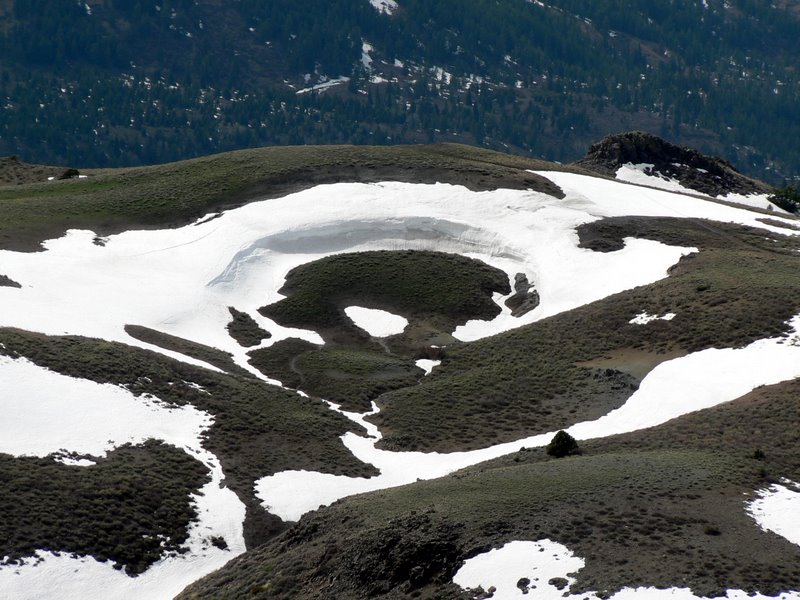
Neat drift on the west side of Quicksilver. |
| |
|
|
| Quicksilver from the south. |
|