Stats
Distance: 15 miles
Elevation gain: 10000'
Class (difficulty): 4 (35 to 40° snow slopes)
Time: 11.5 hours to the summit and back from Camp Schurman
Report:
Even when I wasn’t into hiking, I was always in awe of Rainier as I drove between Spokane and Seattle in the 90’s because you could start seeing the peak hundreds of miles away and it towered above everything around it. As my hiking abilities and fitness increased, I started trying to plan trips to climb Mount Rainier. However, each time as summer drew near someone would have a conflict and plans would be canceled.
This year planning started at the beginning of winter. I must admit that I still wasn’t sure things would culminate in an attempt on the peak. Then Eric Larsen from Idaho Falls informed me that he had 4 guys over in Idaho Falls and one guy from Boise interested in going. As spring came around the planning got more detailed, so I started learning about crevasse rescue (thanks Splattski for the prusik lesson!) and getting gear organized for the trip. Just weeks before the trip, Kevin D. (the other Boise climber going) broke his ankle and was out. Instead of two 3-man teams, it would be one 5-man team.
The route we would be attempting was the Emmons Glacier route. This route is the 2nd most popular route on Rainier. The route requires 10000’ of elevation gain versus just 9000’ of gain on the most popular route (Disappointment Cleaver from Camp Muir). The Emmons route has two high camps, Camp Schurman and Emmons flat. Our permit was for a low camp on the Inter Glacier and high camp at Schurman.
Mount Rainier is the 5th highest mountain in the continental USA. It is also the most heavily glaciated peak in the contiguous United States. The average success rate on Rainier is about 50%. Here are some interesting stats on success rates: http://www.nps.gov/mora/climb/cl_stats.htm
I found these temperature stats interesting:
| Month | High | Low | | January | 7 | -3 | | February | 9 | -2 | | March | 11 | -2 | | April | 17 | 2 | | May | 22 | 6 | | Jun | 26 | 10 | | July | 33 | 15 | | August | 32 | 14 | | September | 28 | 12 | | October | 20 | 7 | | November | 14 | 2 | | December | 8 | -2 |
On Friday, June 30th Eric, Mike, and Dave picked me up on their way through Boise to kick off the trip. We stayed in Pendleton Friday night before arriving at the trailhead in Rainier National Park at around noon on Saturday, July 1st. Kevin, the final group member, was waiting for us at the trailhead (I had met Kevin the year before on a trip on Mount Adams, which was also led by Eric). After meeting with the ranger, filling out permits, and signing our lives away… we drove a few short miles to the Glacier Basin trailhead. At the trailhead we sorted out group gear, double checked everything, then it was off to the races.
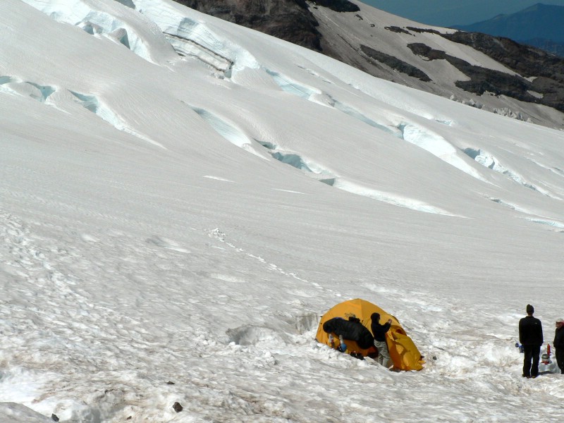
The hike into Glacier Basin was on a great trail through old growth forest, with a glacier fed stream nearby. Mike and I saw a bear early on during the hike, but it had scurried away before we could get out the cameras. As the trail neared Glacier Basin it was covered with deep snow in places, but easily navigated. As we entered Glacier Basin, the views opened up. We could see spectacular rock walls, huge snow-filled cirques, and even the face of Rainier that we would be attempting. Since our first night’s permit was for the Inter Glacier, we continued past the basin and camped around 6700’ on the glacier. After dinner Mike and Dave had the energy to scramble up to St. Elmo Pass and peer over at the Winthrop Glacier. The rest of us hung out and drank our lovely iodine-treated water… mmmmm.
The next morning we woke at a reasonable hour and broke down camp. We had a relatively easy day ahead of us… just climb the Inter Glacier to Camp Curtis, then drop down onto the Emmons Glacier and head up to Camp Schurman. The Inter Glacier sits between two prominent ridges that separate the largest glaciers on Rainier (the Emmons and Winthrop Glaciers). Other than being steep, ascending the glacier was easy and few crevasses were seen. After a rest at Camp Curtis, we down climbed a hundred feet and were now on the Emmons Glacier. Like Eric said, it was time to get our game faces on. We roped up for the ˝ mile hike to Schurman, steering around numerous large crevasses en route. (The rope is used for glacier travel to allow other party members to rescue a climber on the team should they fall into a crevasse, assuming the group can self arrest before they too are pulled into the crevasse.)
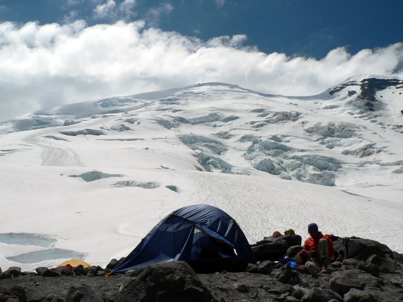
Camp Schurman sits at 9400’ and has a toilet and ranger station built into the side of a rugged mountain called the Steamboat Prow. We actually got a tent site on dirt very near the hut. This is when I learned about a major chore with glacier camping… melting water for drinks. We spent most of the day melting water for lunch, filling water bottles, melting water for dinner, and then melting water for that night’s ascent of Rainier. I honestly believe those stoves were running for at least 5 or 6 hours that day. Other than melting water, eating and resting, we spoke with climbers that had ascended that day. Reports from the summit were that it was windy with low visibility.
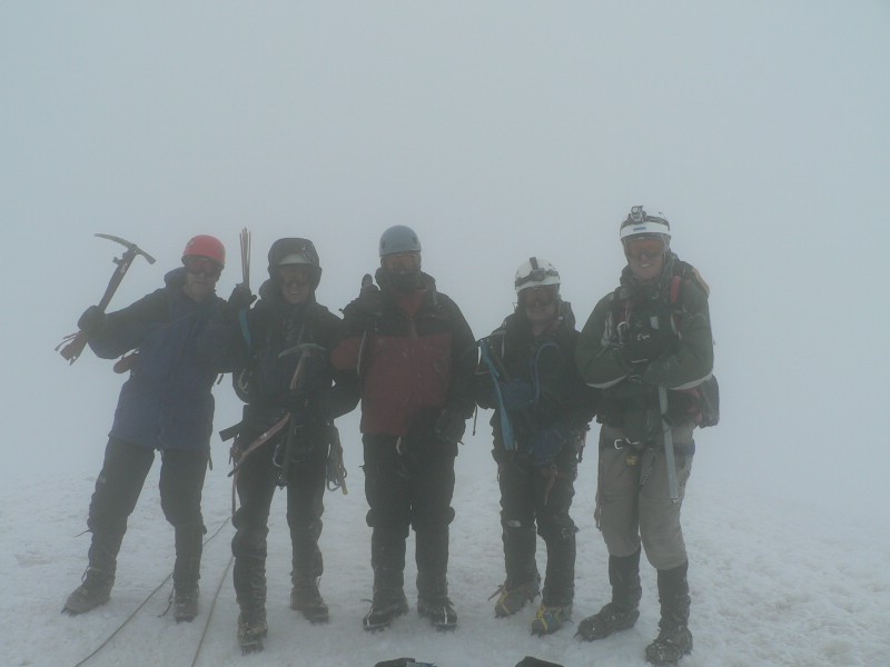
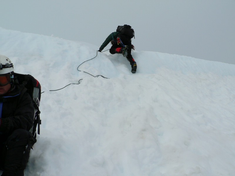
After a late afternoon and evening nap, we awoke at 11pm. The mountain was in cloud and the wind was blowing a bit. We were amazed at the lights of the Seattle Metro area as we put on our gear for the climb and ate “breakfast”. At 12:20am we started the climb. The climb is initially straight forward and on moderate terrain. The snow was rotten, but Eric worked his butt off and broke trail for us. We made good time in the dark and besides one poor turn -- which we quickly corrected -- we stayed on route and maintained a 800’ per hour pace. Around 11,000’ we exited the easy slopes of the Corridor and traversed through an area with huge seracs above and wide crevasses below. The snow was becoming harder, so we donned crampons at that point. Around 12000’ feet we crossed a short snow wall that required front pointing to get up. It was at this point I started getting excited with only a couple of thousand feet to go and everyone was moving well and feeling good. At around 13200’ feet we took a break before crossing a snow bridge that circumvented a bergshrund that is sometimes a challenge for climbers on this route. After that point the visibility dropped and the wind picked up. We trudged on following wands and a boot path without incident to about 13600’. At 13600’ we ran into another party that had quit just shy of the summit because one of their team had gotten sick and thrown up. I don’t think the guide enjoyed my comment of “if someone on our team gets sick, we are dragging them to the summit”. We continued to the Columbia Crest (crater rim), where we unroped and ran for the summit on volcanic rock and with gusty winds and very low visibility. This final section was only a Ľ of a mile with minimal gain, but the wind and long day made it seem like an eternity. Finally I saw climbers coming up from the Disappointment Cleaver route and then saw the summit. I was too exhausted to celebrate, but after a minute of sitting on the ground, I came to and grabbed the camera. By then Kevin had joined us and we took pictures like crazy before getting out of dodge. Mike actually dropped a few feet down below the summit and signed the summit register. I forgot about that, but in those conditions I probably wouldn’t have done it anyway.
Once below the crater rim we stopped for an extended break and prepared to rope back up for the down climb. The descent was tricky because of tired legs and snow that caused our crampons to ball up. We made it to the top of the Corridor and once again removed crampons and just plunge stepped and slid as fast as possible to camp with several stops on the snow to soak in the sights and sun. We arrived back at camp 11 hours and 45 minutes after leaving the night before.
At Camp Schurman we ate lunch, broke camp, chatted with those preparing to climb the peak that night, and then headed down. We glissaded down most of the Inter Glacier and stopped off at our first camp for some cached items before starting the hike out from Glacier Basin. Somehow while we were gone for those couple of days, the trail from Glacier Basin had been extended from 3.5 miles to like 40 miles. After the punishing hike out with heavy packs we finally made it to the White River Campground and recovered before heading on for a celebratory dinner and finally a hotel room in Yakima.
This climb went off without a hitch. Most of the credit goes to the guys I did the climb with. Everyone got along, joked, had fun, but really pitched in when work had to be done and the route got challenging. I always wondered how I would do with glacier travel, challenges like climbing 5000’ after an hour or two of sleep, multiple days of tough hiking with a pack, etc… I must admit that my body did very well. Even on the hike out I was exhausted, but still keeping a good pace. Other than a sore neck, I was back to normal the day after the climb. Rainier was such a goal, I am not sure what the next big challenge will be. Guess I will have a few weeks of down time to contemplate that.
Getting there:
Make your way to Yakima, Washington. From Yakima, turn west on US 12 to SR 410. West on SR 410 over Chinook and Cayuse Passes to the White River Entrance, White River, and Sunrise turnoff (summer only).
Hiking instructions:
See the trip report. Due to snow conditions, the route will vary from year-to-year and even between seasons.
|
|
Photos
|
|
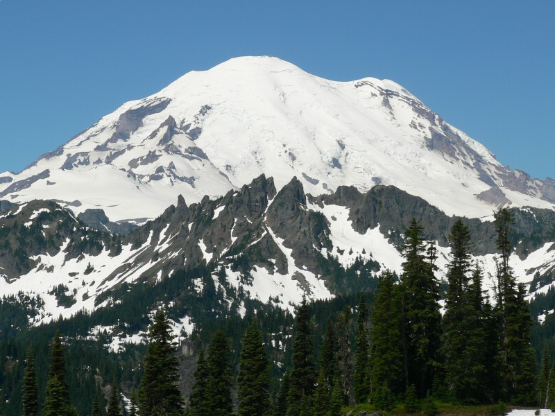
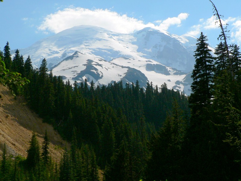
| Rainier from Chinook Pass the day we started the approach. |
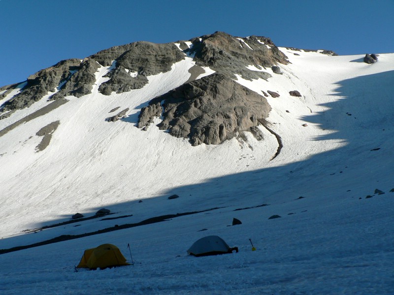
Camp 1 on the Inter Glacier. |
| |
|
|
|
| The route up to Schurman from camp 1. |
Looking down from the route up the Inter Glacier. |
| |
|
|
|
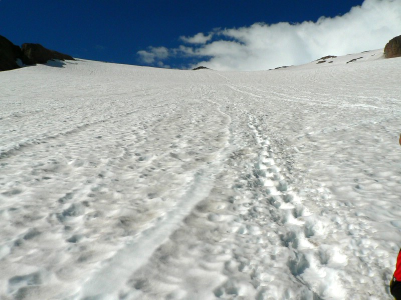
| Looking up at the rest of the route up the Inter Glacier. |
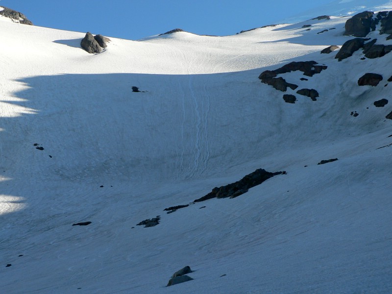
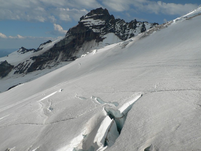
Little Tahoma from Schurman. Notice the snow bridge on the crevasse. |
| |
|
|
|
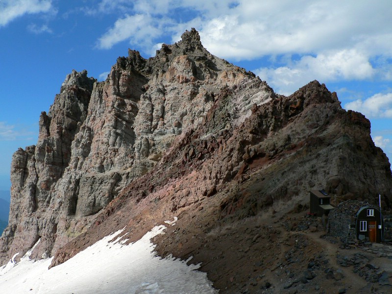
| Steamboat Prow from camp. Notice Camp Schurman and the solar toilet in the bottom right. |
Seracs from Schurman. |
| |
|
|
|
| The route from camp. |
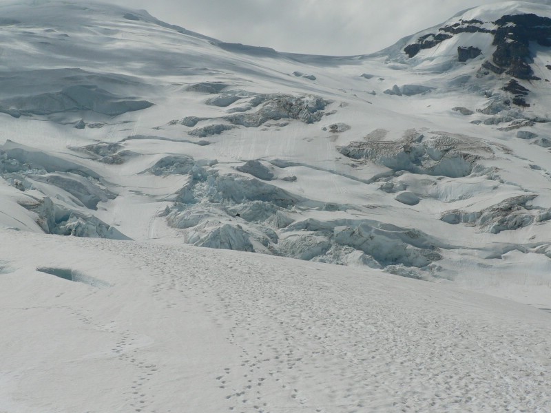
Crevasses from camp. |
| |
|
|
|
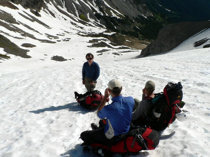
| The team on the summit. |
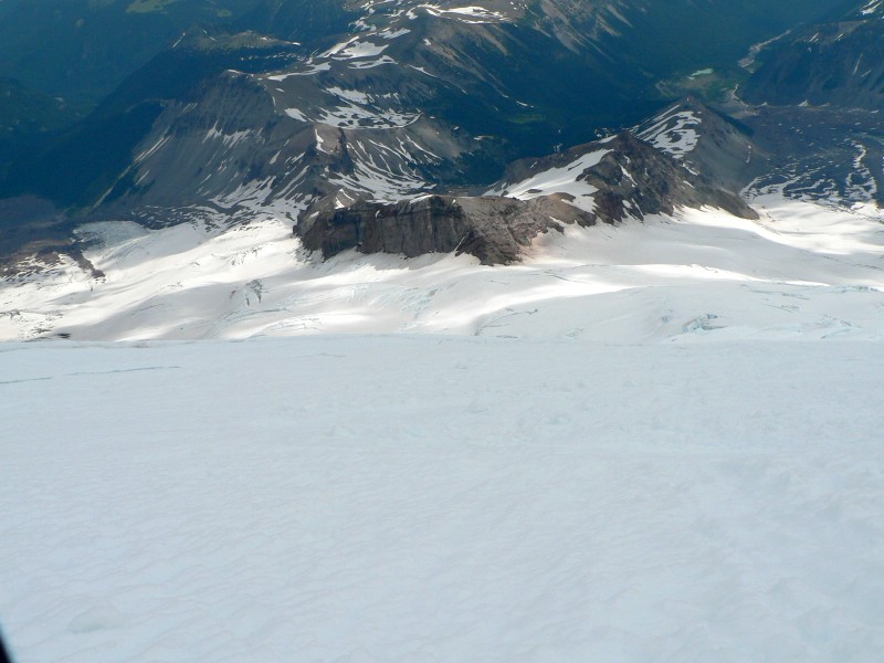
Looking down the route from about 12,500'. |
| |
|
|
|
| Eric downclimbing a steeper section. |
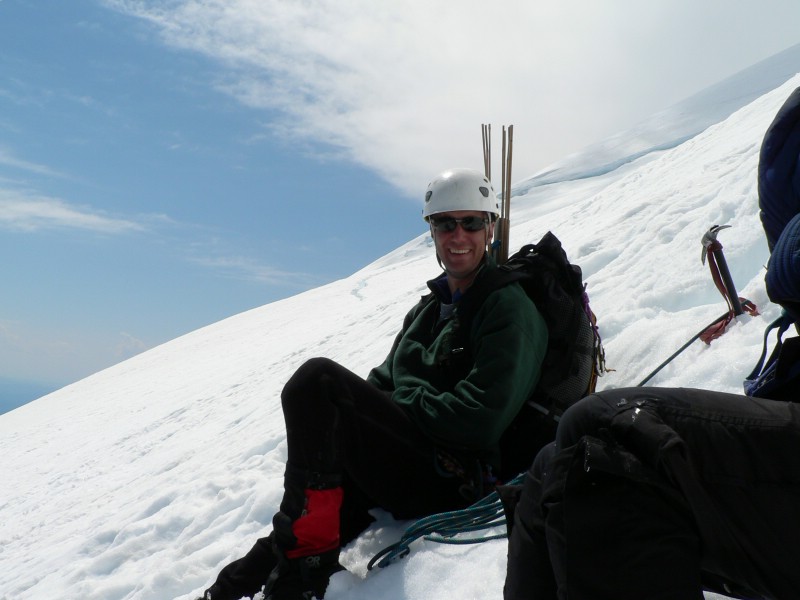
Eric relaxing in the sun on the lower slopes. |
| |
|
|
|
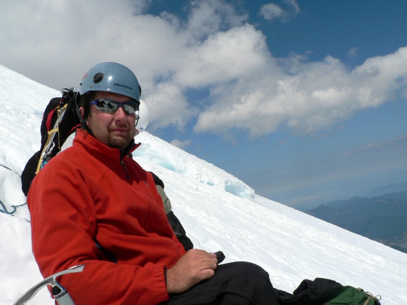
| Me relaxing in the sun on the lower slopes. |
Rainier from the trail on the hike out. |
|