Stats
Distance: 17 miles
Elevation gain: 4000'(cumulative)
Class (difficulty): 3
Report:
My quest to summit the county highpoints of Idaho brought me to the Sawthooths to ascend Snowyside Peak, highpoint of Elmore County.
Joining me on this trip were John and Ramon, a couple of friends from work. Each had experience backpacking, but neither had done a peak before. I could tell they were very apprecitive of the backcountry and would enjoy the added thrill and views that came with a top of a big peak like Snowyside.
Our first day took us to Alice Lake. This is a 6-mile hike to one of the most popular (understandably) lakes in the Sawtooth range. We had planned to haul the packs up to Toxaway Pass, drop them while we ascended Snowyside, then pick them up on the way down and head to Toxaway Lake to complete a loop hike back to Petit Lake. Comfortable with our campsite and the beauty of Alice Lake, we decided just to day hike Snowyside Peak from there and return to camp at afterward. No lugging packs up to the pass, no breaking down and resetting camp... no problem!
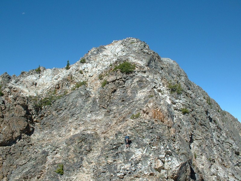
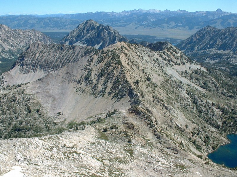
From Alice Lake, Snowyside is about 5 miles roundtrip with a 2200-foot elevation gain. A trail gets you to Toxaway Pass, then you basically head west on open slopes until you reach the point where you must turn north to climb to the top of Snowyside. We found goat paths in this area that were quite useful. Once you start heading north, just stay right on the ridge top. You will cross about 3 walls that require easy class 3 climbing. These walls look daunting, but are actually very enjoyable to scramble up.
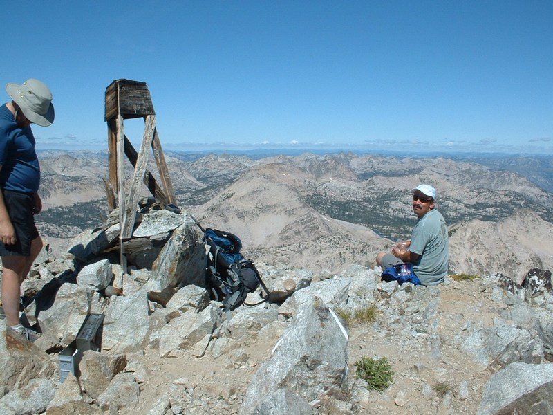
On top is a wooden cairn and a very nice register. We counted 30+ lakes in view, with seemingly every basin sporting at least a lake or two. John and Ramon did well on this section and seemed impressed with the summit views.
The rest of the trip was pretty relaxing. It got fairly cold the last night, with ice on my water filter case and rain fly. Other than that, the weather was perfect for all 3 days!
Getting there:
From ID-75, approximately 19 miles south of Stanley, turn west on FS-208 (the Pettit Lake road) and follow the signs to the Tin Cup hiker trailhead. Parking at the trailhead is abundant (over 100 cars) and requires a recreation pass (get one at REI or the Stanley Ranger Station for $5 - 3 days - or $15 - 1 year).
Hiking instructions:
See the trip report. Basically make your way to Toxaway Pass after hiking past Alice Lake, then Twin Lakes. Take the ridge west from the pass, then turn north and scramble to the summit.
|
|
Photos
|
|
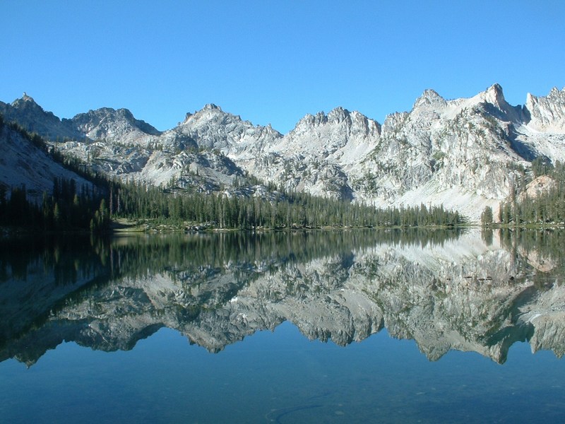
| Alice Lake in the morning. |
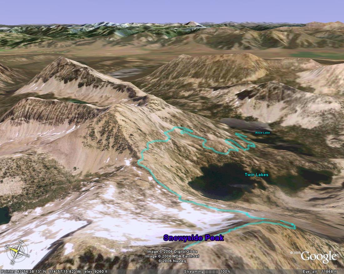
The route on Snowyside with our GPS tracks superimposed. |
| |
|
|
|
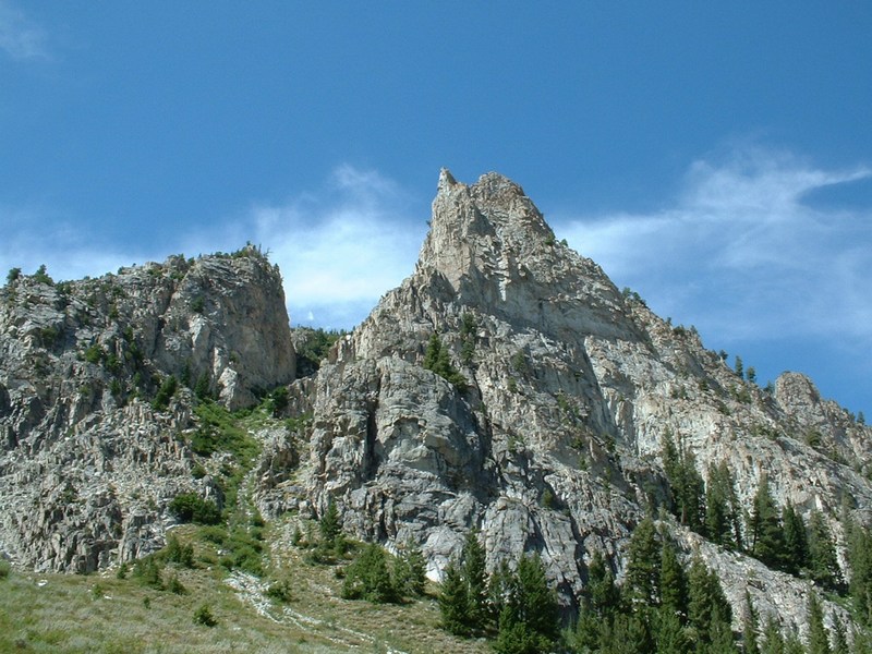
| Tower on the approach to Alice Lake. |
El Capitan from the trail. |
| |
|
|
|
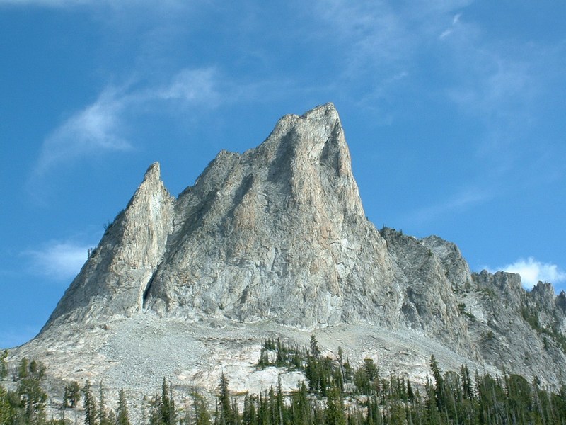
| El Capitan from Alice Lake. |
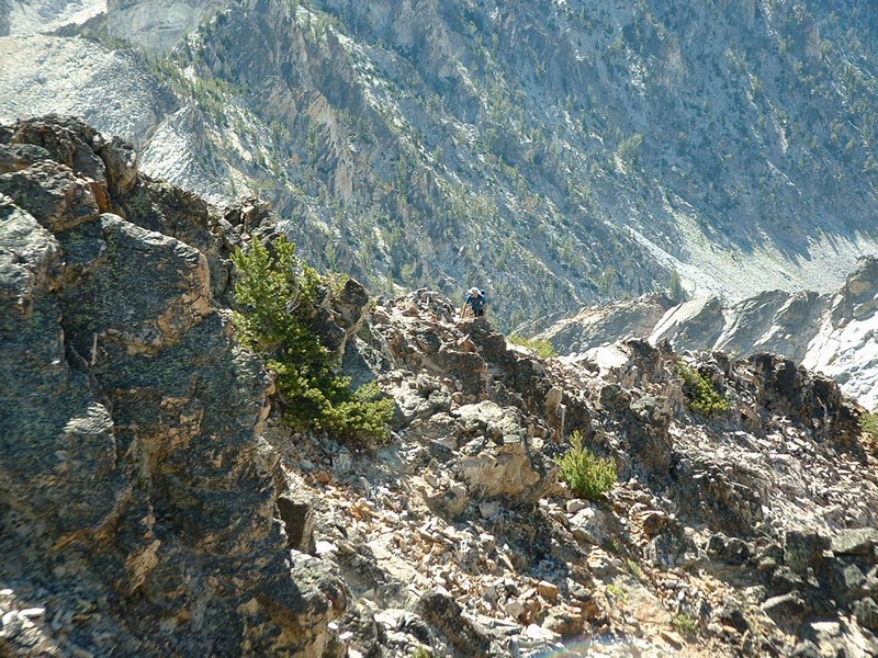
Ramon climbing above me on the east ridge of Snowyside. |
| |
|
|
|
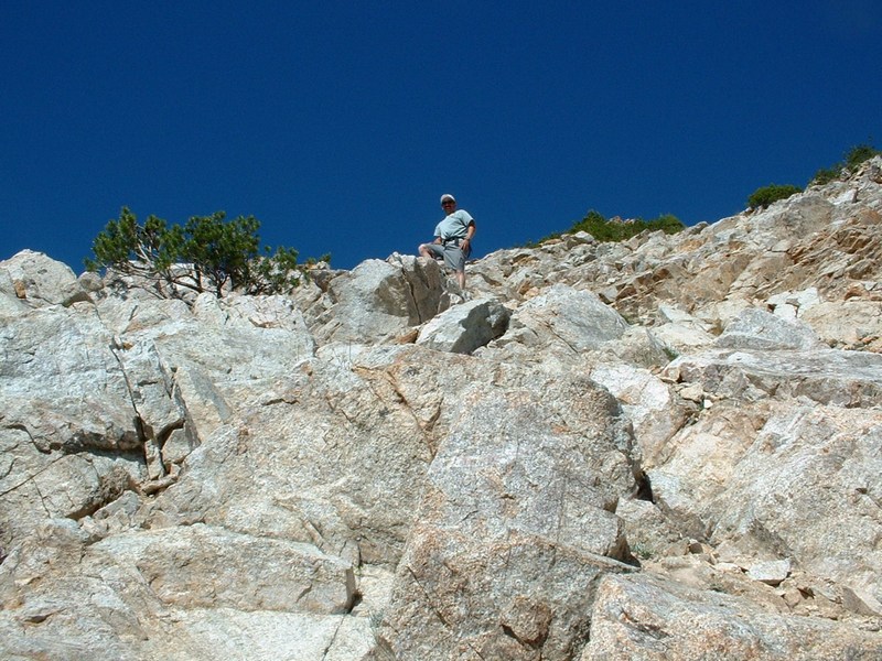
| John coming up the north ridge. |
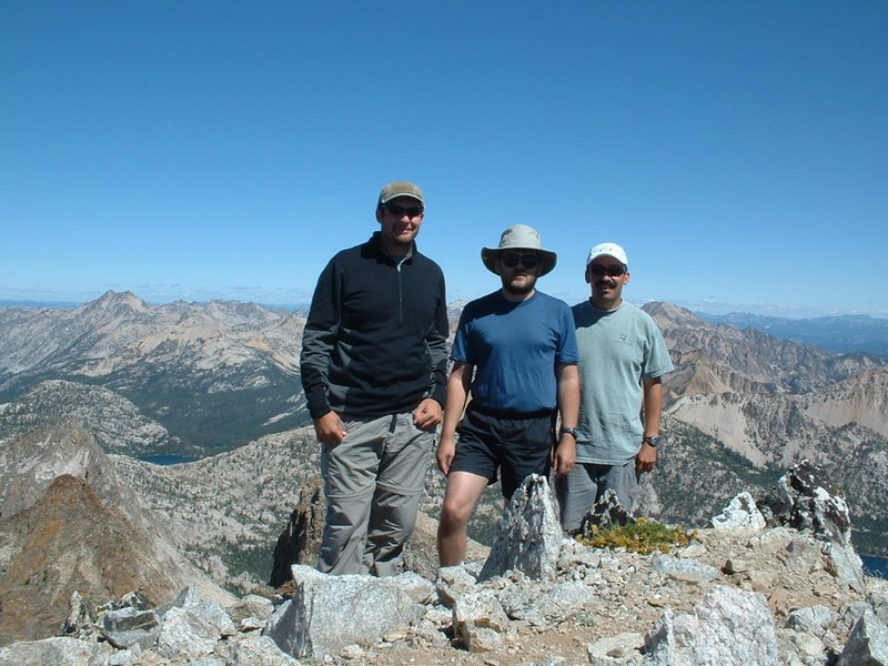
The summit team. |
| |
|
|
|
| The top of Snowyside Peak. |
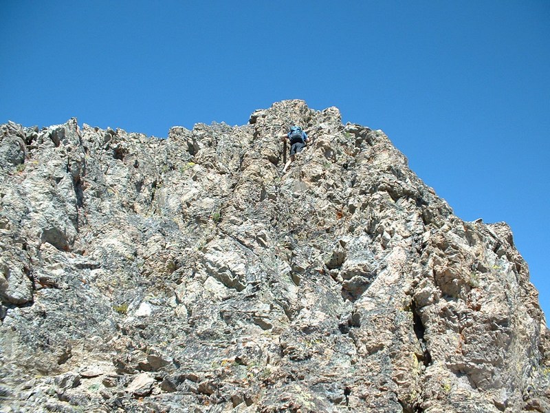
John descending the crux of the ridge. |
|
|
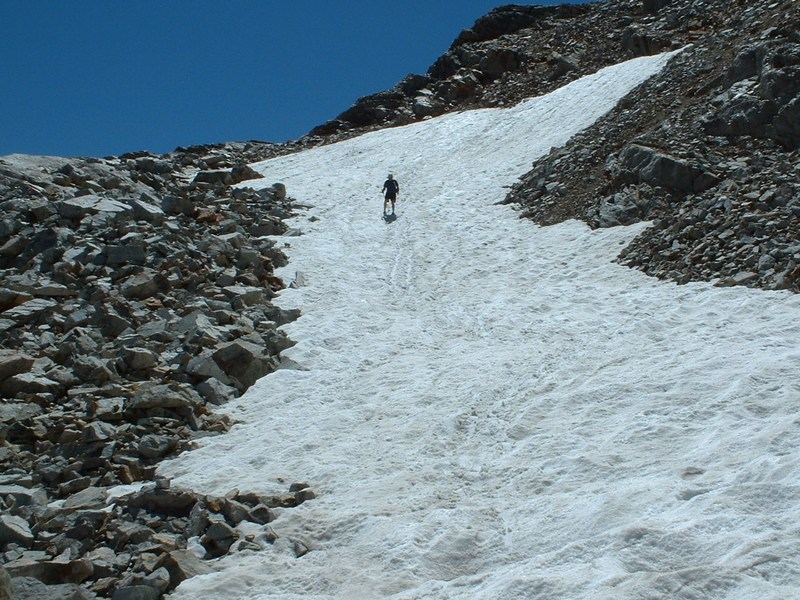
| Coming down the snow that gives Snowyside its name. |
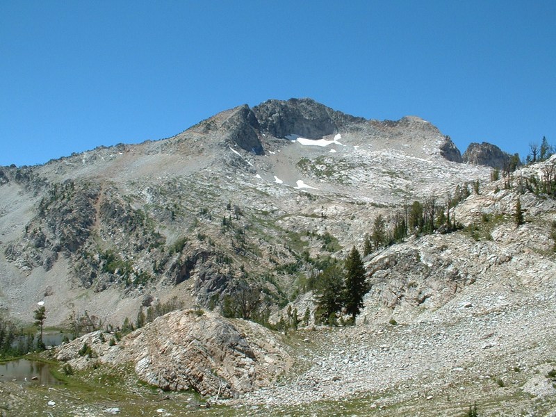
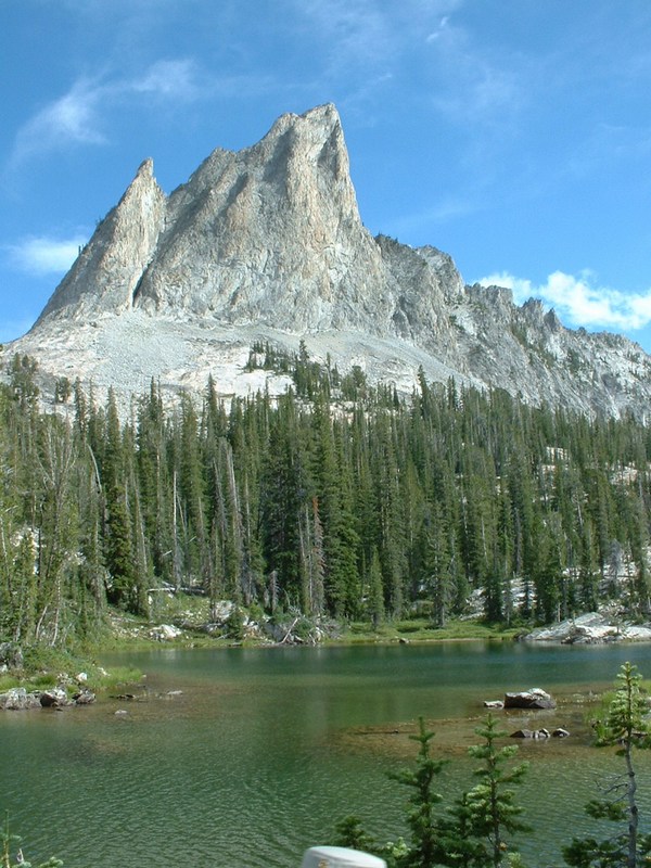
Snowyside Peak. |
| |
|
|
|
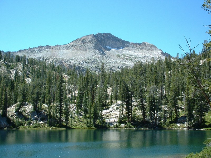
| Snowyside Peak from Alice Lake. |
Pond with peaks reflecting in it. |
| |
|
|
|
| Parks Peak and the White Cloud peaks beyond. |
Another shot of El Cap from the trail. The guys at work liked this best. |
| |
|
|
| Close-up of John on he crux of the ridge. |
|