Stats
Distance: 10 miles
Elevation gain: 4700'
Class (difficulty): 3
Time: 11 hours
Report:
For several months, Dave Pahlas and I have kicked around the idea of bagging 5 peaks in a big loop around Washington Basin in the White Cloud Mountains of Idaho. The time finally arrived where both of us had an open date, so we put it on the schedule. Worries of snow covered peaks almost deterred us, but John Platt didn't seem interested in our easier alternatives. As we debated the different peak ideas, Dave hit us with the "Black Crazy Route" idea late on Friday afternoon. It was a hit with John of course, so we worked out the details and met at 5:00am, knowing we had a long day before us.
So the "Black Crazy Route" consisted of one vehicle and group of 3 (JJ, Dave, and myself) driving to 4th of July Creek trailhead and parking; and a second group (John and his brother Tom) parking on the other side of Washington Basin at the start of the road into Washington Basin (in Germania Creek). We would then each follow the ridge, bagging as many peaks as possible and swap keys near the middle peak (Washington Peak), then drive each other's vehicles out and meet at the highway.
So off we drove to Stanley, mostly in the dark. As we turned south and the sun's rays brought us some light, we could tell there was snow on the peaks, but not a crazy amount that would prevent us from pulling this off. We parked near the 4th of July Creek trailhead with cold temps and snow on the ground.
We followed the 4-wheel drive road that heads toward Phyllis Lake briefly, then headed straight up the hillside to the northwest ridge of 4th of July Peak (10713'). This ridge is easy class 2 and has astounding views of the northern White Clouds, 4th of July Basin, the Sawtooths, etc... It was becoming a beautiful day and this easy terrain and ramped ascent was giving us a good start. The summit added great views of Castle and our route for the rest of the day. It all looked doable, but the next section (up to Ivory Peak - 10408') was obviously the crux because of steep, rocky slopes and a snow covered knife-edge ridge. From the summit of the 4th of July, we also noticed about 15 goats on a slope far way from us. Interestingly, John and Tom were watching those same goats from the other direction as they scampered up Bible Back Mountain on the other side of the basin.
From 4th of July Peak, we dropped down to the saddle and had an extended break (our second already), before heading up Ivory Peak. I played around on the ridge initially, taking hard lines on the ridge, but eventually the ridge had no easy routes and we found ourselves carefully climbing up tough class 3 terrain that was made difficult by pockets of snow. We powered through and I found the ridge extremely fun and challenging. Later I would comment to John how fun it would be for him, knowing he had more aptitude for steep stuff than I do, but being tired and descending, that ridge was not as fun for them as it was for us going up it. We contacted each other on Ivory Peak for the first time and got some initial beta. They were also 2 peaks into the traverse and heading to Washington Peak. We dropped down once again and marched up Ebony Peak (10514').
The dark slopes of Ebony Peak (hence the name) were a nice break after the ridge up to Ivory. Even with easy slopes, this ascent took a long time. We spent little time on Ebony and moved through side-hilly and loose terrain as we raced toward Washington Peak to keep pace with John and Tom, who had covered more distance than us so far in less time. We could see them atop Washington Peak as we traversed, then met them at the saddle between Washington Peak and Peak 10510'. We exchanged beta, keys, and stories. We chatted quite a while, but both had a lot of elevation left to gain, so headed our separate ways.
The ridge to Washington Peak from the meeting locale was fairly tricky, as it was loose, steep, and narrow. The slopes of Washington reminded me of WCP-9 and DO Lee in the northern White Clouds. Views of the Boulders, Castle Peak, the Champion Lakes, Lost Rivers, and Sawtooths from this vantage point were incredible. After a short break, off we headed down a nice trail to a saddle beneath Point 10180. We limped up and over Point 10180 and faced a steep and bouldery area that John had warned us about. We all took separate lines, mine being the slowest and were now at the base of Croesus Peak, with 1000' of climbing to go for the day.
Croesus was an easy stroll on class 2 terrain. The views remained the same, with even more of the Boulders in play now as we ascended the true highpoint on Croesus, and then headed for the point named on the map. I forget at what point we saw goats here, but several of them meandered on the slopes in front of us almost maintaining our pace. As we reached the named Croesus peak (complete with a cairn and wood pole), we could see up close the remaining ridge and descent back to the car. The light was getting low, the drop down to Bible Back looked tricky, and we were trashed. However, we decided the way back went toward Bible Back anyway, so let�s drop to the saddle and think about our options from there.
So we finally reached Bible Back's base with no possibility of reaching John and Tom at our estimated time of 6pm. We were tired, out of water, and running out of daylight. As we sat near an old cabin and large adit, something came over me and I just couldn't back off this last peak. The others put up no fight and we headed slowly up the final 400' feet of the day on loose, then class 3 slopes to our 6th (and final) summit of the day. Elation was there, but it was muted by lack of water and our need to get down quickly. Down we ran on loose slopes to the road that would lead us to John and Tom's vehicle at the trailhead. The road never seemed to come, and once on the road, the car never seemed to come. But eventually, just before dark, we arrived.
I wasn't comfortable driving someone else's car (especially a Porsche SUV), but it had to be done and on a not so great road. We were slow to start, but boogied once we hit the gravel road on the flats of the Sawtooth Valley. As soon as we hit the highway, we saw my Durango (as they were heading to find our late butts!) and the trip (minus the 1.5 hour wait on pizza in Stanley and 2.5 hour drive home from there) was over.
Hopefully John and Tom weren't too upset with our late arrival, as all else went perfect on this fine day in the mountains. To be honest, I am not sure I can go back and think of a better day in the mountains. Good people, great route idea, incredible terrain and views, great weather (clear and cool)... just amazing. If I ever forget why I love that mountains, a day like this would put it back into perspective immediately!
Getting there:
To get to 4th of July Creek TH:
Turn east on the signed turnoff for the Fourth of July Creek Road (3.6 miles south of Obsidian or 3.3 miles north of the Petit Lake turnoff), which heads into the White Cloud Mountains. After about 10 miles, you reach the end of the road at the Fourth of July Creek trailhead. You'll find plenty of parking, a trail register, and a bathroom at the trailhead. This road was rebuilt in the 1990's to accomodate cars of all types. Save your gas money and bring your sedan.
To get to Germania Creek TH:
Turn north onto Highway 75 and travel 36 miles past Ketchum over Galena summit. Once into the Sawtooth Valley, turn right on the Pole Creek-Germania Creek Road and drive 4.6 miles on gravel and 7.5 miles on a primitive surface over Pole Creek Summit through 3 fords of Germania Creek to a trailhead at Three Cabins Creek at 12.1 miles. Here take a road heading north for about 2.5 to a trailhead (the road continues), park here. This road requires a 4x4 for 98% of the population.
Hiking instructions:
Click on the map below to see the route:
|
|
Photos
|
|
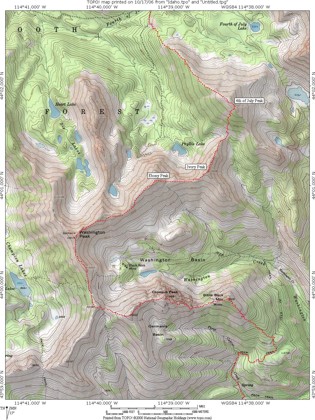
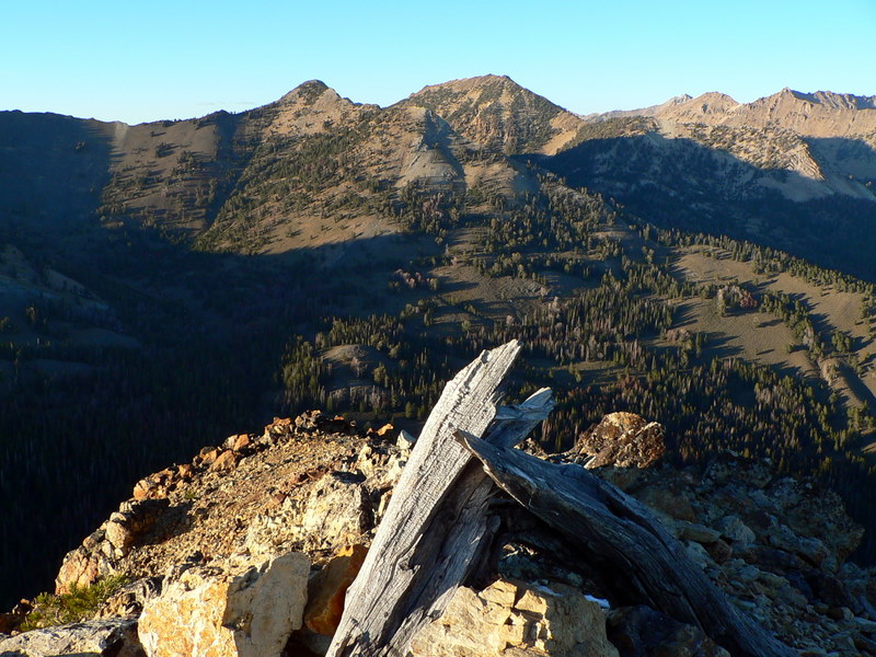
| Ebony Peak, Point 10500, and Washington Peak from the slopes of 4th of July Peak. |
Ebony Peak's northside. |
| |
|
|
|
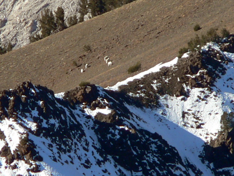
| Goats spotted miles away on Ebony Peak. I like the little dude hanging out on the snow drift. |
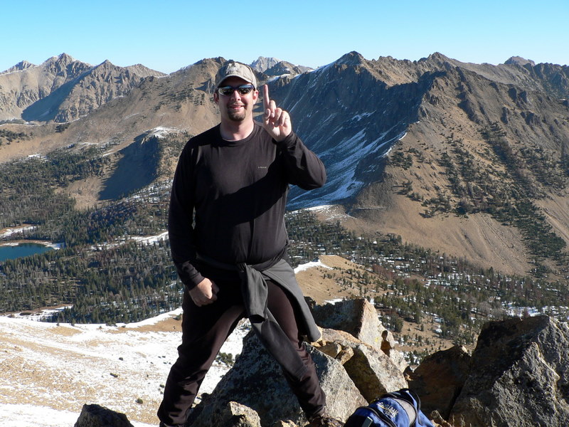
Me on top of 4th of July Peak indicating peak #1 of the day (I later hold up 6 fingers, but I spare you all 6). |
| |
|
|
|
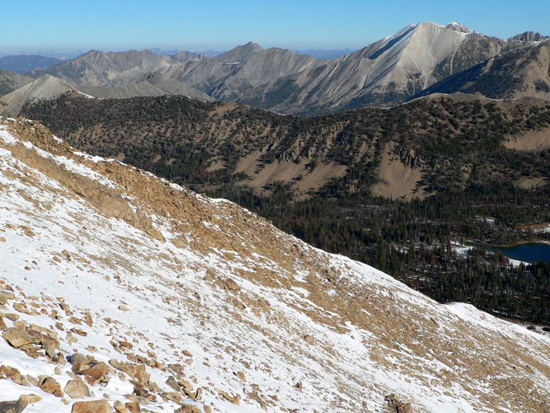
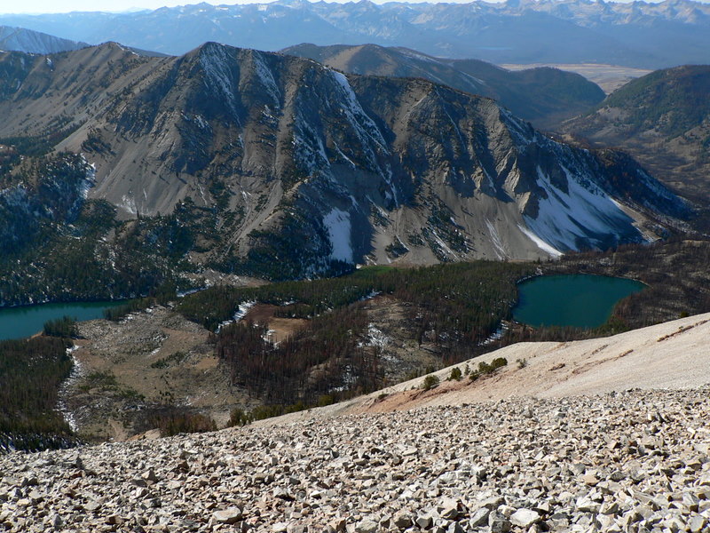
| The northern White Cloud peaks with 4th of July Lake in the foreground. |
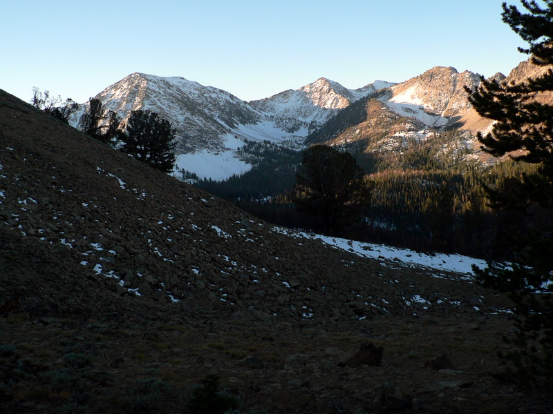
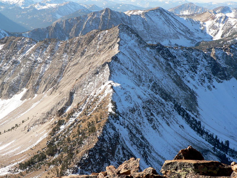
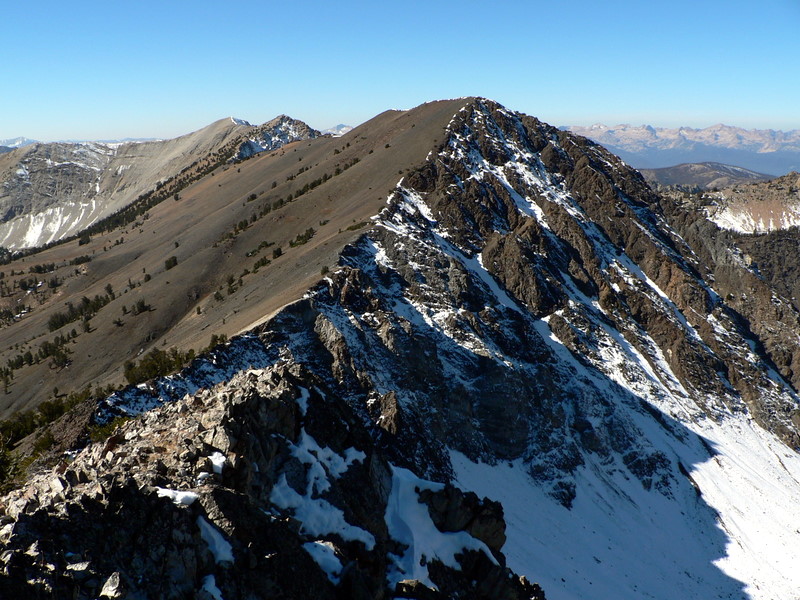
Ivory Peak (10408'). The most technical part of the traverse. |
| |
|
|
|
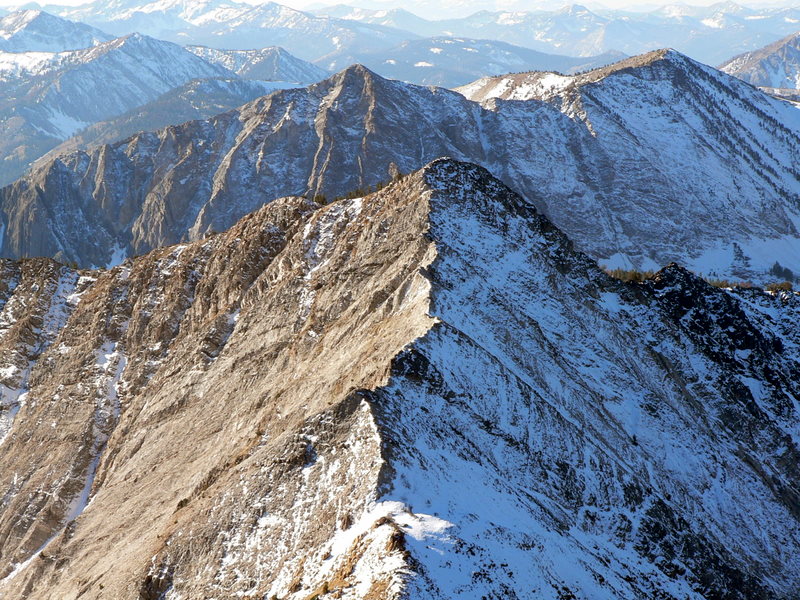
| A little more close look at the ridge. |
The ridge to Ebony from atop Ivory. |
| |
|
|
|
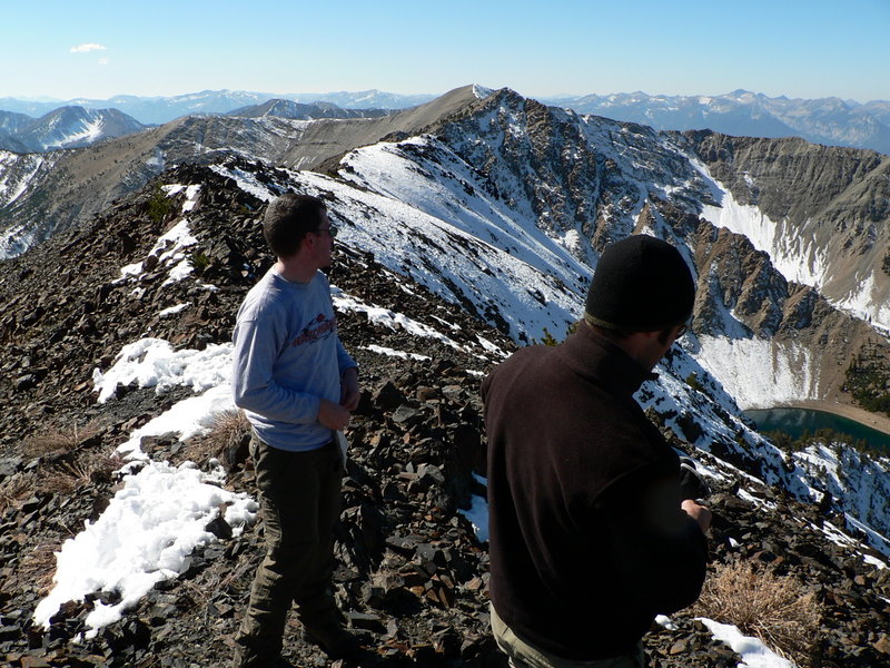
| JJ and Dave on Ebony Peak. |
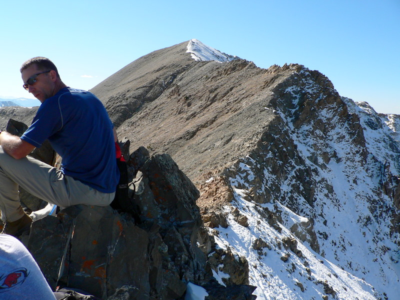
Tom on with Washington Peak in the background. |
| |
|
|
|
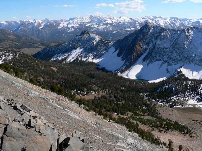
| Washington Basin with Croesus Peak in the background. |
Champion Lakes from atop Washington Peak. |
| |
|
|
|
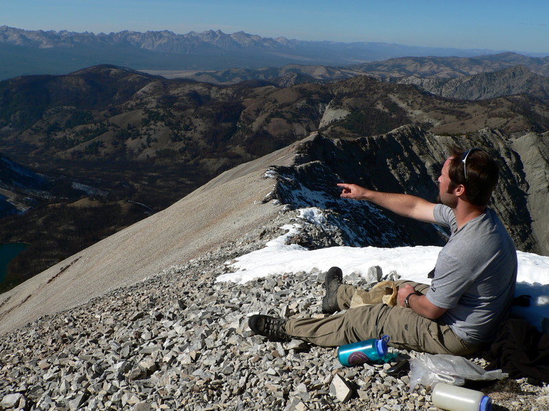
| JJ pointing something out while on Washington Peak. |
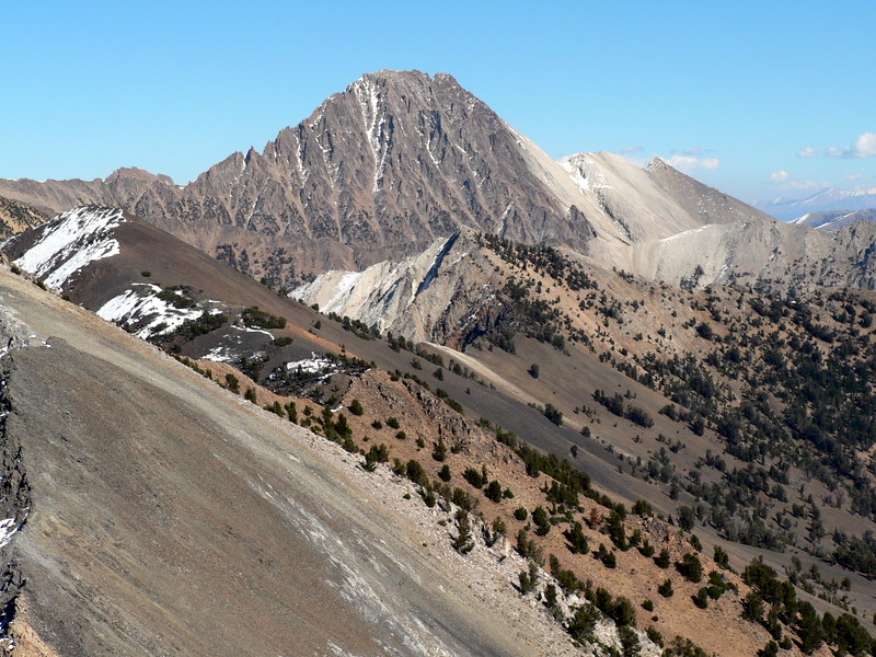
Castle Peak making the peaks we just climbed look pathetic. |
| |
|
|
|
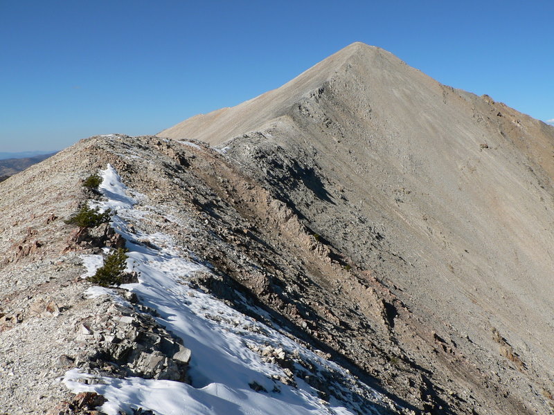
| Washington Peak's south ridge. |
The ridge to Bible Back Mountain from Croesus. |
| |
|
|
| A picture of the 1st and 2nd peaks ascended from the last peak ascended (Bible Back Mountain). |
|