RockyMountainSummits.com Home  |  My Peak List  |  Message Board  |  Contact Me  |  View the Guestbook  |  Sign the Guestbook


Bell Mountain


Looking up at the west face, see if you can find the 2 climbers (Tom Lopez photo).

Trip Report (5/1/2004):

Last spring Jim and I really enjoyed a snow climb up the Super Gully on Lost River Peak. We followed that up with another enjoyable snow ascent of Mount Hood. So this spring, I thought it would be fun to get together some of the regulars on the forum for a snow ascent of Bell Mountain.

We had an initial group set, with most of them from the eastern side of the state. Then the group started to shrink, as my friend broke his ankle, Earl remembered it was prom night, etc... Only Richard Wallace (Summit Dawg) and Craig Peck (Tetonmaniac) remained. That is when Dean Lords accepted an invite. Later Tom Lopez would accept an invitation as well. Dean brought Mike and Josh Howard along to complete the team. Other than myself and Richard, the rest of the team were experienced rock and snow climbers. I guess it is good that the team turned out this way, as a snow covered Bell Mountain is not a place for beginners by themselves in my estimation. I guess when I was making plans, I thought the steepness would be similar to Lost River or Mount Hood, but it turned out to be much steeper than both.

The group camped out at the head of Basinger Canyon and got to know one another over dinner. We then set a wake up call of 5 AM and hit the sack. In the morning, Dean shuttled us to Black Canyon on the southwest side of Bell Mountain to ascend the southwest couloir. We hiked up Black Creek for a mile, before turning into the left fork of the creek. Another mile of hiking put us at the base of the couloir and it was time to crampon up. We could see some ice near the top of the couloir in one of the three bottlenecks in the couloir, but it appeared you could move around it. So the group headed up and reached the first bottleneck in little time. The experienced climbers negotiated this problem in seconds, but us newbies struggled with the icy slopes a bit, which made for a good teaching opportunity. Eventually, we reached the ice formation we saw from below, Tom found an easy route around it, though Dean went staight over the 10 foot ice formation with his tools. This brought us to low angle snow slopes that led to the west face.

I thought we had been through the crux already, but the gully up the west face was very steep. Mike and Dean walked me through it, teaching me how to crampon up something that steep and getting me some confindence. By the upper part of the face, I was tired and mentally drained, but was much more confident in my cramponing abilities. Other members of the group took seperate gullys and even ridges to the top.

The top was basked in sun (we hadn't had any all day coming being on the west side of the mountain) and nearly windless. We hung out for quite a while before heading down. One group headed down the southwest couloir again, and one down the west ridge and Basinger Canyon.

Getting down the gully was on the west face was tiring and slow, but not as bad as I expected. Heck, I didn't even need anyone there telling me what to do, after brief instruction on how to down climb snow of that steepness. After getting off the face, I was one of the one's that headed down the west ridge, which was uneventful for the most part, but required some easy class 3 climbing to get around obstacles on the ridge. Once off the snow and in the trees, we were able to make good time.

The weather was great, with not a cloud in the sky. The climb went great, with everyone getting down safe. The group of guys on the trip were awesome, and no better way to learn than from the best!

Trip stats:
Time: 9:15 (4:15 up, approx. 1 hour on top, 4 down)
Length: 7 miles
Elevation Gain: 4500 feet (descended 5000 feet)
Class (difficulty): 4 (45 to 50 ° Snow Slope)

Drive:

Make your way to the head of Basinger Canyon. To do that, take the Pahsimeroi Highway north from Howe. Make your way north up the Little Lost River Valley to Clyde, which is just a couple of small houses and government office on the right hand side of the road. From Clyde, the turnoff for the Bell Mountain Creek Road is 5.8 miles. There are no signs marking the turnoff, but you can see some sheep pens off to the east. Follow the road east towards the base of Bell Mountain's west ridge. From the highway it is 4.1 miles to the head of the canyon. The road is not too bad, but crosses a pipe that was a bottom scrapper even on my 4x4. A high clearance vehicle is definately needed.

From the head of Basinger Canyon, you can reach the southwest route by following one of the roads shown on the quad that runs southwest from Basinger Canyon. Drive 2.2 miles, then turn left (east) when you reach Black Creek and follow the deteriorating road to its end at 5.3 miles and 7300 feet.

To do the normal route up the west ridge, follow the road up Basinger Canyon until it you reach a switchback at 7600 feet. There is some parking at this point.

Route:

The normal route on Bell is to follow the road up Basinger Canyon to 7600 feet and park. Follow one of the tree covered slopes to the west ridge. From the ridge, make your way to the base of the summit block and follow one of the class 3 gullies to the summit.

On our trip, we utilized the southwest couloir from Black Creek. This is rated class 4 during the summer.

There is a route from the east that is rated class 3. Technical routes exist on the north side of the peak.

Pictures: Click on the pictures below to see the full-size version.
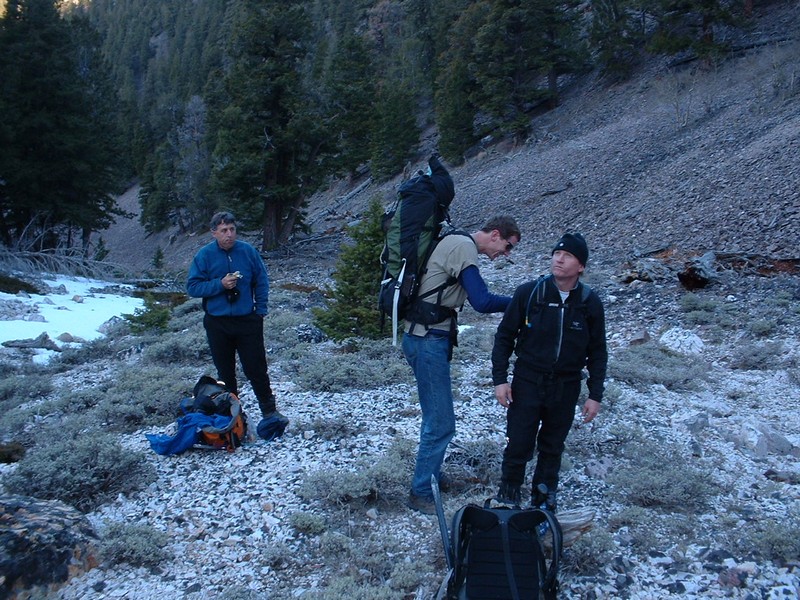
Tom, Richard, & Craig early on.
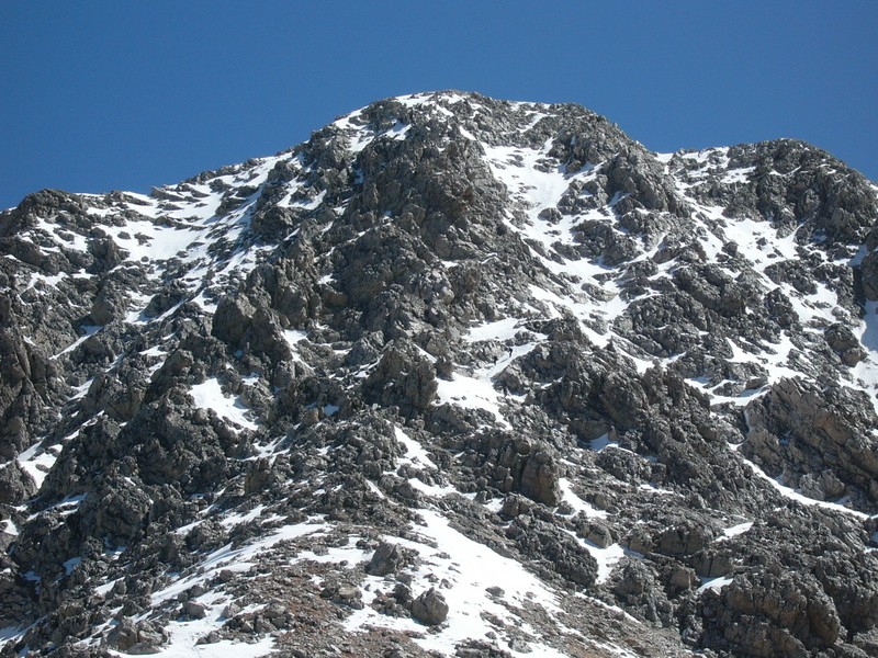
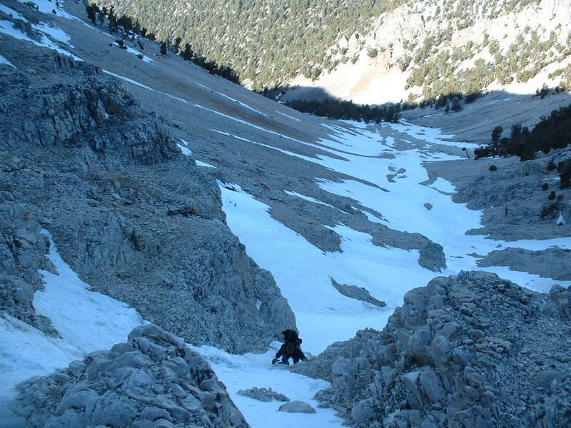
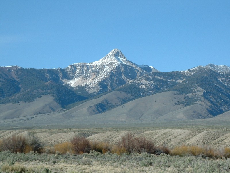
Our first look at the route.
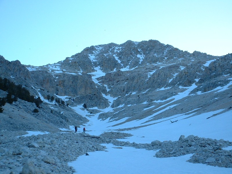
Close up of the southwest couloir.
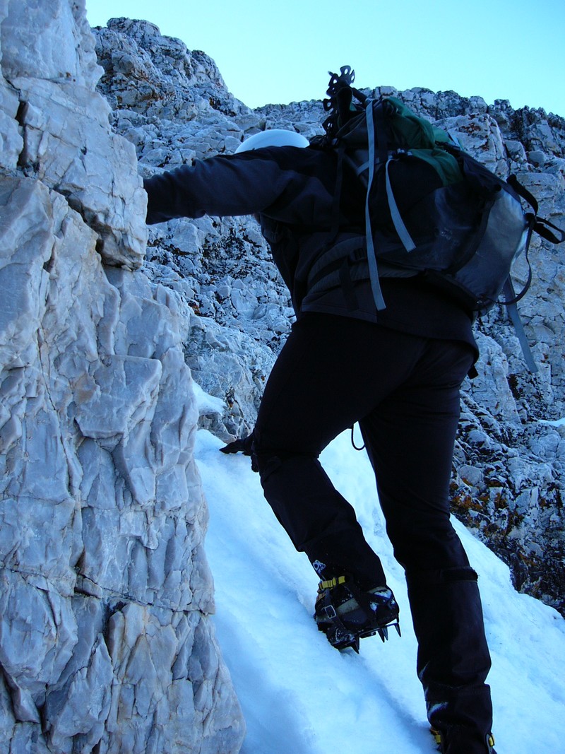
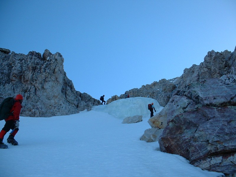
Me ascending one of the steep sections (Tom Lopez photo).
Looking down at Richard, Mike, and Josh (Tom Lopez photo).
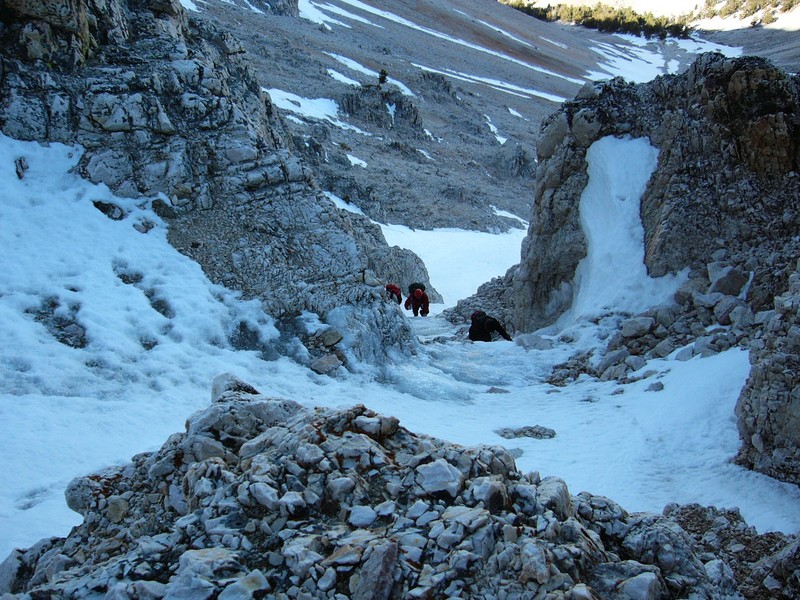
Richard coming up the 1st narrow section of the couloir.
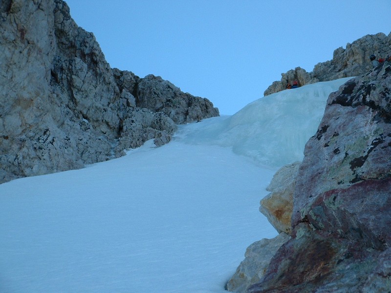
Ice bubble in the couloir.
Another shot of the ice.
Diamond Peak from the top.
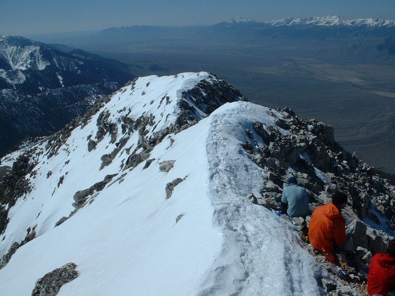
The top of Bell Mountain.
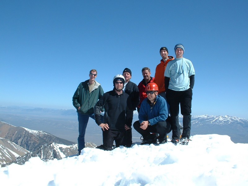
Group photo on the summit.
The group resting on the summit.
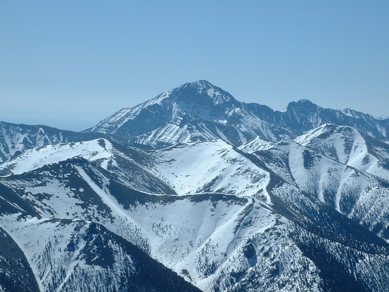
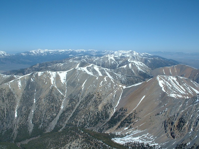
Borah and the other northern Lost Rivers.
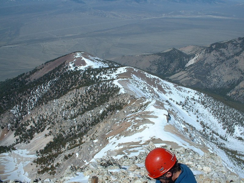
Looking down at the west ridge.
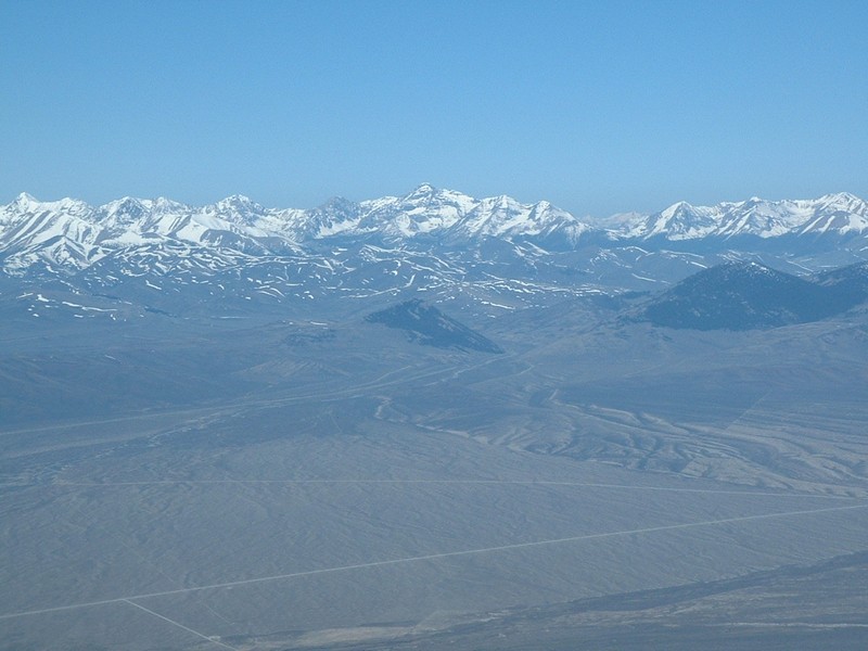
Lemhi Range heading north.
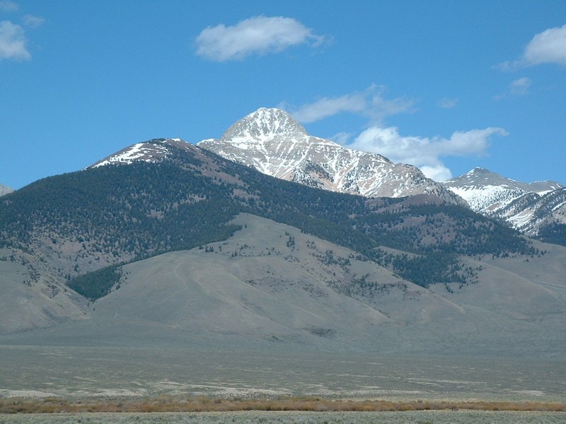
Bell Mountain, we followed the snow couloir in the middle of the mountain.
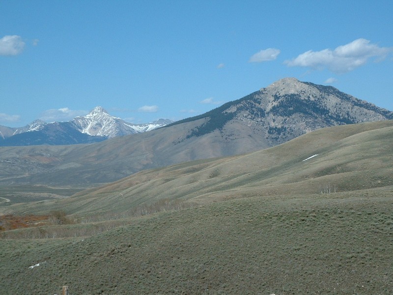
Bell Mt. (Hawley Mt. foreground) from Pass Creek Road.
Bell from the southeast.
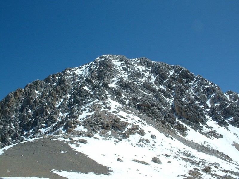
Looking up at the west face.


Please send comments, suggestions, and questions to dan@idahosummits.com.
© 2001 All Rights Reserved RockyMountainSummits.com