Devil's Bedstead East - 11865
The fall 2005 Idahosummits outing started forming before the final steps had even been taken on the spring outing. The popular choice was the Devil's Bedstead East (DBE).
DBE is a enormous mountain located in the heart of the Pioneer Mountains of Idaho. It has numerous faces that drop several thousand feet to the valleys below. It is highly visible from several other peaks, and is often the impressive mountain to the southwest that people ask about at the Borah Peak trailhead.
All week the weather forecast seemed a bit questionable for the day of the climb, but the precipitation percentage in the forecast never got above 30 percent. When Dave Pahlas and myself arrived at the campground the night before the skies were cloudy, with intermittent light rain showers. Summitdawg and Brendon would later join us at the Wildhorse campground. During the night, we heard a few sprinkles of rain, but nothing too bad.
We awoke when Mike H., his brother Terry, and Eric L. had arrived. We got ready and headed to the trailhead. Mike, Terry, Eric, and Sean had already headed up the trail. Us campers met Kevin D. and Michael at the trailhead to formulate the rest of the team. At 7:20am we departed under cloudy skies with fresh snow visible on the high peaks when visibility allowed us to see up there.
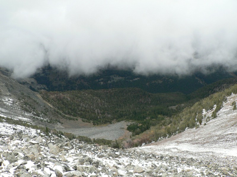
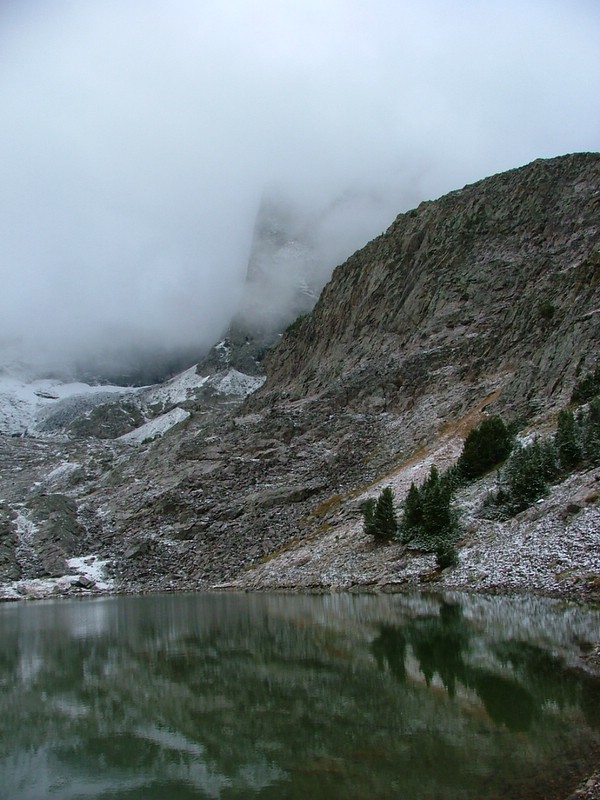
We were utilizing the Boulder Creek approach, which several of us had done the day after the fall outing on Angel's Perch last year. The creek crossing can be tricky at the beginning of summer, but was not an issue for us on this trip. Besides the crossing, the rest of the trail is in great shape, and the 6 of us made great time and ran into Sean a couple of miles after starting. We would continue onto the trail until reaching the point where it abruptly turns south, crosses Boulder Creek, and enters into a basin with views of DBE and several other impressive peaks and rock walls. Here we found the cairned turnoff that would lead us up the slope to our west and eventually to a small, unnamed lake 1/2 a mile north of Washington Lake. At the unnamed lake, the entire team joined up and we hiked west up a steep slope to the DBE/Peak 10942 saddle. At the saddle we took our first significant break, donned helmets, and enjoyed blue skies. We were now going to head up the northeast slopes of DBE toward the summit.
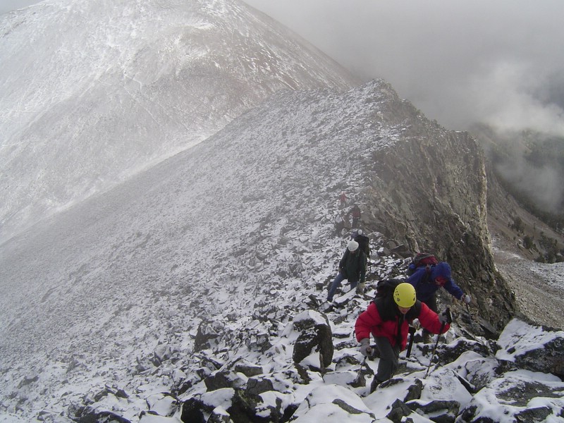
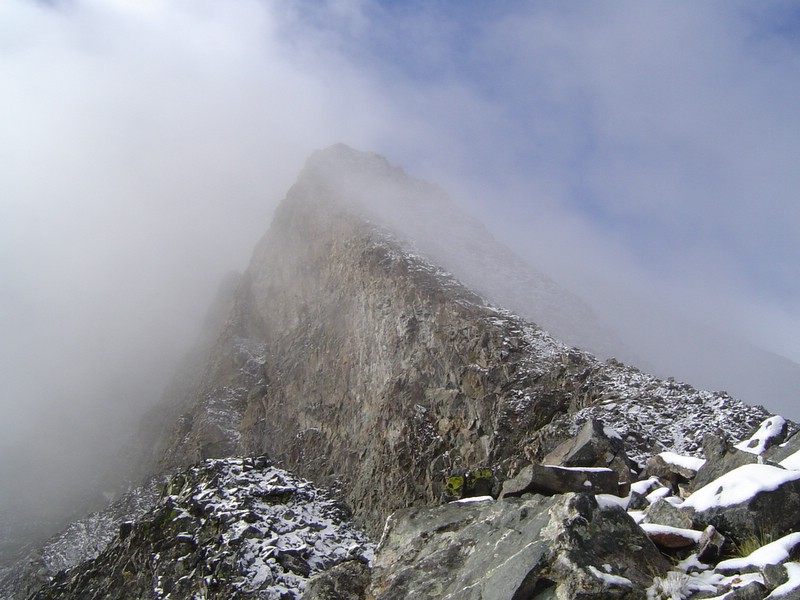
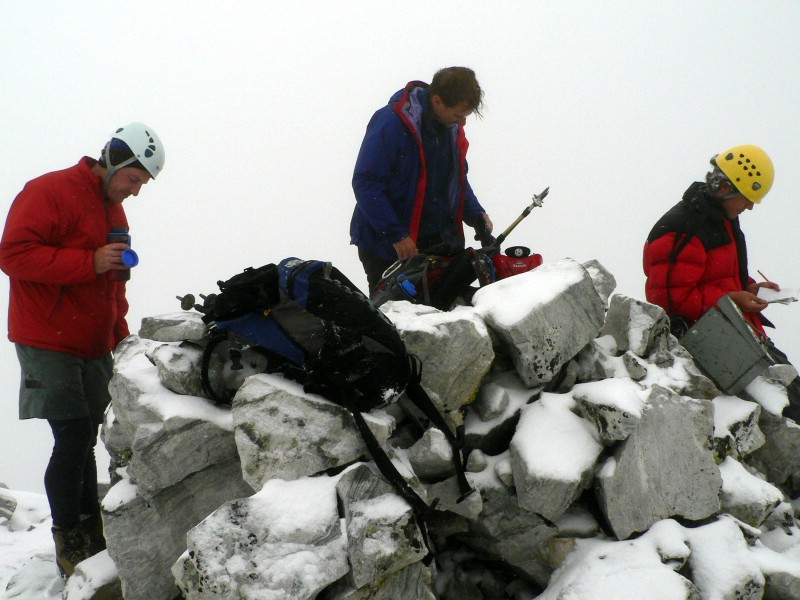
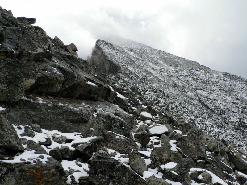
The initial part of the ridge was fun, with easy terrain on a pinnacled ridge. We made it up to about 10900' when several in the group started heading west toward the easier terrain in the gully and Mike, Terry, and Summitdawg headed directly up the northeast ridge. The gully had decent footing, especially between about 11200' and 11700'. Other than a few impressive rockfalls (one of them igniting some of the biggest rock bounces I've ever seen and one nearly taking out a climber), the climbing was slow, but steady as clouds moved in and it started to snow. At 11700', we started up the final portion of the climb directly on the ridge. This was fine until a tricky move about 100' below the summit. Several of us watched Eric and Dave come down the crux. I then went up it, finding out it was easier than I thought. Sean followed me up and we summited about the same time... followed closely by Michael, Kevin and the "Richard's Ridge" ascenders. The top had small visibility and snow was falling. We signed in, snapped photos, and got the heck out of there sooner than we wanted to.
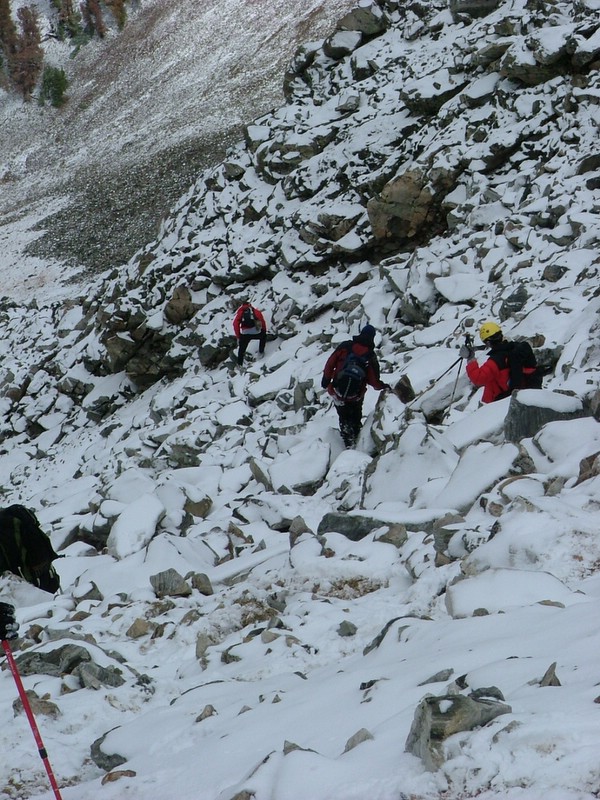
The way down was fairly nerving for the first 1000' feet on the slippery rocks. We made it to the saddle without incident and even rested as the weather broke for a few minutes. Once we started heading back, it starting snowing fairly hard and that would remain with us the hike out and turn to rain at the trailhead.
I've got to admit that this was a tremendous effort by everyone in the group. I didn't hear one person complain about the weather and everyone kept their focus and made it through the steep terrain on less than ideal footing without major incident. Everyone got along and nobody really dropped off the group's pace. I couldn't be happier with the 4 outings we've had so far, and I hope the future ones are attended by as many great people as this one was. Thanks for the great trip guys!
Stats
Time: 8.25 hours
Distance: 9.5 miles
Elevation gain: 4600'
Class (difficulty): 4 (based on slippery holds from falling snow)
|
|
Photos
|
|
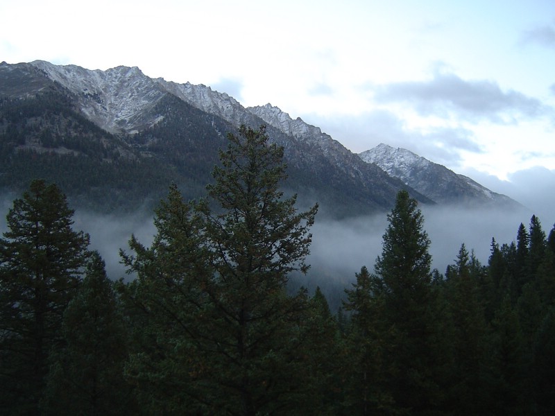
| Angel's Perch and Wildhorse Canyon from the trail. Dave P. photo. |
The Devil's Bedstead East from Boulder Creek. |
| |
|
|
|
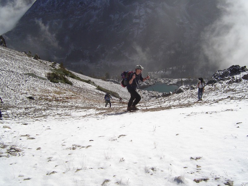
| The group approaching the saddle at 10500'. Dave P. photo. |
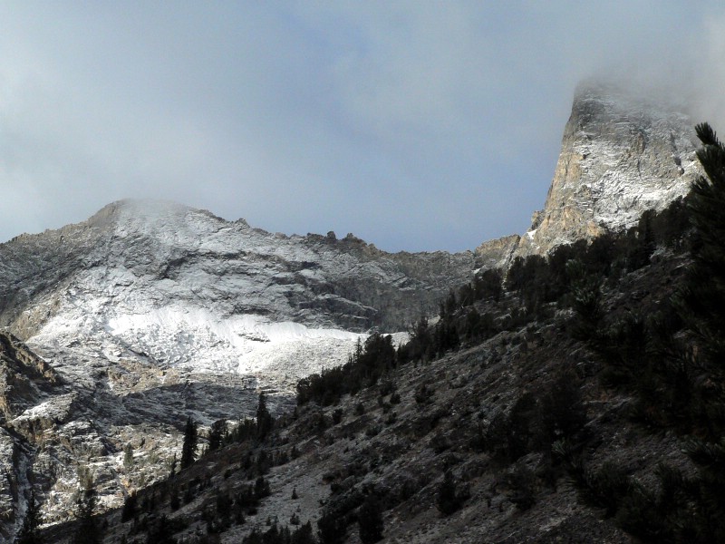
Dave's impressive photo of DBE from the saddle north of the peak. Dave P. photo. |
| |
|
|
|
| Looking down the northeast ridge near the saddle with Peak 10942. Dave P. photo. |
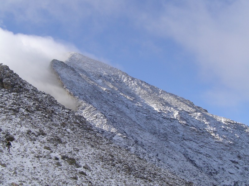
Looking up the northeast ridge. Dave P. photo. |
| |
|
|
|
| Kevin, Michael, and Sean on top. |
One of the Howards on the ascent ridge. |
| |
|
|
|
| Looking down the northwest ridge. |
The group working their way down the face. Mike H. photo. |
| |
|
|
|
| Kane Canyon. |
The north face of DBE after our climb. |
| |
|
|
| Unnamed Lake where the cross-country travel begins. Mike H. photo. |
| |
|
|